This chapter discusses climate change impacts and approaches to adaptation across the Atlantic region.
Recommended citation
Dietz, S. and Arnold, S. (2021): Atlantic Provinces; Chapter 1 in Canada in a Changing Climate: Regional Perspectives Report, (ed.) F.J. Warren, N. Lulham and D.S. Lemmen; Government of Canada, Ottawa, Ontario.
Coordinating lead authors
Sabine Dietz, Aster Group Environmental Services Co-op
Stephanie Arnold (University of Prince Edward Island Climate Research Lab)
Contributing authors
Randy Angus, Mi’kmaq Confederacy of Prince Edward Island
Tony Bowron, CBWES Inc.
Robert Capozi, Government of New Brunswick
Adam Cheeseman, Nature NB
Stéphanie Collin, Université de Moncton
Omer Chouinard, Université de Moncton
Cyr Couturier, Memorial University
Briana Cowie, Eastern Charlotte Waterways
Peter Duinker, Dalhousie University
Anne Fauré, Conservation Council of New Brunswick
Alison Feist, Brock University
Adam Fenech, University of Prince Edward Island Climate Research Lab
David E. Foster, Dalhousie University
Kurt Gamperl, Memorial University
Shilo Gempton, Halifax Regional Municipality
Stuart Gilby, MTI (Mi’gmawe’l Tplu’taqnn Inc.)
Jen Graham, Government of Nova Scotia
Tom Johnson, MTI (Mi’gmawe’l Tplu’taqnn Inc.)
Donald Killorn, Eastern Charlotte Waterways
Van Lantz, University of New Brunswick
Anne-Marie Laroche, Université de Moncton
Serge LaRochelle, Pays de Cocagne Sustainable Development Group
Vincent Leys, CBCL Limited
Vett Lloyd, Mount Allison University
Brandon Love, Government of New Brunswick
Mélanie Madore, New Brunswick Public Health
Patricia Manuel, Dalhousie University
Amanda Marlin, EOS Eco-Energy
Raissa Marks, New Brunswick Environmental Network
Shannon Miedema, Halifax Regional Municipality
Simon Mitchell, WWF-Canada
Peter Nishimura, Government of Prince Edward Island
Josh Barrett, Newfoundland and Labrador Office of Climate Change
Kathleen Parewick, Municipalities Newfoundland and Labrador
Hope Parnham, DV8 Consulting
Prativa Pradhan, Government of New Brunswick
Adrian “Adje” Prado, New Brunswick Northwest Regional Service Commission
Chkwabun Sappier, Wolastoqey
James Steenberg, Nova Scotia Department of Lands and Forestry
Infrastructure is being threatened by increased flooding and erosion
Climate change is amplifying existing flood risks in Atlantic Canada’s coastal areas and in locations that are prone to overland flooding and erosion. Recognizing the risks, a range of adaptation measures are being implemented, including changes to infrastructure design, such as using engineered protective structures, as well as nature-based approaches to protect the coast.
Climate change is exacerbating risks to health and well-being
People living in Atlantic Canada are facing significant risks to their physical and mental health and well-being from climate change. Climate change exacerbates health issues associated with existing vulnerabilities in the region, which are influenced by factors such as socioeconomic status, ethnicity, employment and living arrangements. Adaptation measures include public education, vulnerability mapping and actions to address health risks and their underlying factors.
Indigenous experiences inform adaptation in Atlantic Canada
The Mi’kmaq, Wolastoqiyik and Peskotomuhkati Nations of the Wabanaki Confederacy have occupied the Maritimes since time immemorial and have adapted to changes in climate and the environment over countless generations. Partnerships with, and leadership by, local Indigenous peoples are vital to ensuring that the knowledge, perspectives and experiences that they hold from living on the land, inform adaptation in their communities and in the region.
Forestry, agriculture and fisheries are vulnerable to climate change
Atlantic Canada’s natural resource industries are vulnerable to the impacts of climate change. While examples of adaptation are found in each sector―forestry, agriculture, fisheries and aquaculture―there remains a lack of collaboration amongst stakeholders to reduce risks from climate change.
Building adaptive capacity will strengthen resilience
Adaptive capacity in Atlantic Canada is often constrained by limited human and financial resources. Partnerships and collaboration between different stakeholders—including governments, NGOs, academia and the private sector—are important for driving adaptation in the region. Outreach, public education and effective communication are key for building adaptive capacity in Atlantic Canada.
1.1
Introduction
Share
Atlantic Canada comprises the provinces of New Brunswick (N.B.), Nova Scotia (N.S.) and Prince Edward Island (P.E.I.) (collectively referred to as the Maritimes), as well as Newfoundland and Labrador (N.L.). Situated on the east coast of the country, Atlantic Canada spans three different climate regions that include cool humid-continental, sub-Arctic and Arctic tundra (Vasseur and Catto, 2008) and consists of regions and communities that differ in many ways, including population densities, natural resources, key industries and cultures. With approximately 42,000 km of coastline (Lemmen and Warren, 2016), Atlantic Canada is characterized by diverse coastal systems including sandy beaches, estuaries, intertidal flats, salt marshes, cobble beaches, cliffs, bluffs, rock shores and more (van Proosdij et al., 2016). This chapter does not include Nunatsiavut in Newfoundland and Labrador, as this region is discussed in the Northern Canada chapter.
1.1.1
Demographic profile
Share
Atlantic Canada makes up 6.5% of Canada’s population. The population in the region grew by only 2.2% over the past 20 years, while the country as a whole experienced a 22.9% increase over the same time period (see Table 1.1). Atlantic Canada’s population is ageing, with projections estimating that 31.1% of the total population will be over the age of 65 years by 2038, compared with the national average of 25.5% (Statistics Canada, 2015a).
Table 1.1
Past, present and future population demographics for individual Atlantic Provinces, the Atlantic Canada region and Canada as a whole
N.B.
N.L.
N.S.
P.E.I.
Atlantic Canada
Canada
Population (2018)
770,633
525,355
959,942
153,244
2,409,174
37,058,856
Population change (1998‒2018)
2.7%
-2.7%
3.0%
12.8%
2.2%
22.9%
Population change (2018‒2038*)
-2.3%
-12.9%
-1.5%
18.9%
-3.0%
17.4%
Immigrants (2018‒2019**)
5,076
1,653
6,395
2,267
15,391
313,601
Emigrants (2018‒2019**)
601
152
1,047
54
1,854
51,290
Net interprovincial migration (2018‒2019)
1,669
-2,597
3,632
662
3,366
0
Percent of population aged 65+ (1998)
12.9%
11.3%
13.2%
13.2%
12.7%
12.3%
Percent of population aged 65+ (2018)
20.8%
20.5%
20.4%
19.6%
20.5%
17.2%
Percent of population aged 65+ (2038***)
31.0%
33.9%
30.4%
27.4%
31.1%
25.5%
Median age (1998)
36.5
35.9
36.8
35.9
n/a
36
Median age (2018)
45.9
46.5
45.1
43.6
n/a
40.8
The projected data were derived using the M3 medium growth scenario. Sources: Statistics Canada, 2019b; Statistics Canada, 2015a for data marked with a single asterisk; Statistics Canada, 2020a for data marked with double asterisks; Statistics Canada, 2019c for data marked with triple asterisks.
For the period 2013‒2017, the median annual income of residents in each Atlantic province was below the national median of $33,766 (Statistics Canada, 2019a). Over 46% of Atlantic Canadians live in rural areas and small communities, compared with 18.6% nationwide (Statistics Canada, 2019d). Many Atlantic communities are dealing with declining, ageing populations and diminishing economic resources leading to less capacity to adapt to risks, changes and hazards (Vasseur and Catto, 2008). However, communities with long-term residents who have strong local ties to the region can have enhanced adaptive capacity (Vasseur and Catto, 2008).
The Mi’gmaq, Wolastoqiyik and Peskotomuhkati Nations of the Wabanaki Confederacy have occupied Atlantic Canada since time immemorial (Indigenous and Northern Affairs Canada, 2013; Francis, 2003). The Atlantic region is also home to 3.5% of the country’s Inuit population (although this is mainly in Nunatsiavut, northern Labrador; see Northern Canada chapter), 7.5% of the First Nations population and 7.2% of the Métis population (Statistics Canada, 2017).
1.1.2
Economy
Share
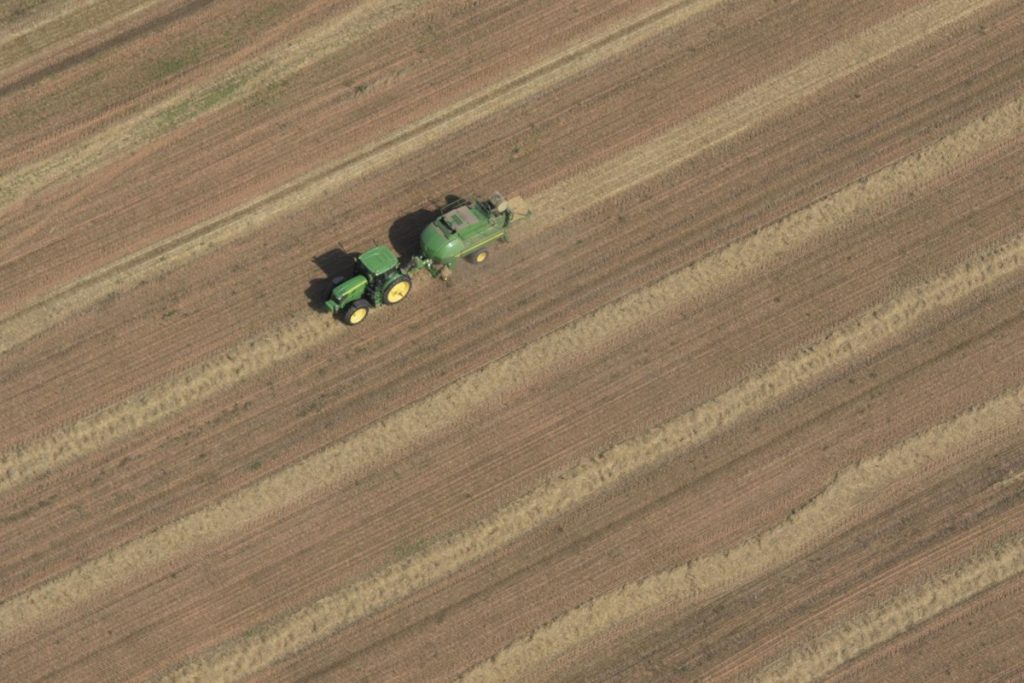
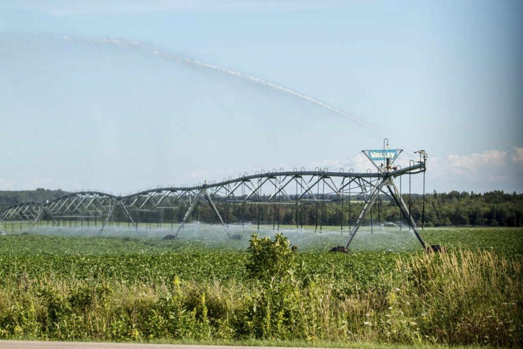
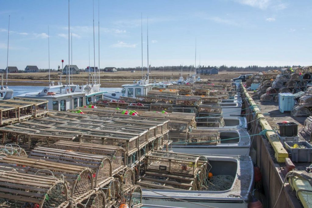
Key industries in Atlantic Canada include agriculture, fisheries and aquaculture, forestry, tourism, marine transportation, shipbuilding, information technology, mining, oil and gas, renewable energy, manufacturing, aerospace and bioscience (Nova Scotia Business Inc., 2020; Government of Newfoundland and Labrador, 2017; Government of Prince Edward Island, 2016). Some of these sectors may experience new opportunities from climate change—for example, higher temperatures can lead to longer tourism and growing seasons. Negative climate change impacts, however, are expected to predominate, particularly in sectors that are sensitive to projected changes in climate due to their reliance on natural resources and marine and coastal infrastructure, such as fisheries, aquaculture, agriculture, forestry, transportation and offshore oil and gas (Vasseur and Catto, 2008).
1.1.3
Changes in climate
Share
Between 1948 and 2016, the annual mean temperature across Atlantic Canada increased by 0.7ºC, and the normalized annual precipitation increased by 11% (Zhang et al., 2019). In contrast to other regions in Canada, warming has been driven by increases in summer temperature rather than increases in winter temperature (Cohen et al., 2019; Zhang et al., 2019). Climate change impacts can result from increases in mean temperature and mean precipitation over time, as well as changes in climate extremes. Projected trends for a number of climate variables vary within and among individual provinces and local regions (see Figure 1.1 and Table 1.2).
Figure 1.1
Share
Figure 1.1
Interactive regional map of the Atlantic Provinces that draws from climatedata.ca and visualizes various climate variables from 1980 to 2100 under three different emissions scenarios: RCP 2.6 (low), RCP 4.5 (medium) and RCP 8.5 (high).
Projections of different climate variables for each Atlantic Province
1976-2005
2021-2050
2051-2080
RCP4.5
RCP8.5
RCP4.5
RCP8.5
median
versus
median
versus
median
versus
median
versus
1976-2005
1976-2005
1976-2005
1976-2005
Temperature
Mean Temp, ⁰C
NB
4.5
5.4
0.9
7.9
3.4
7.4
2.9
10.3
5.8
NL
-1
-0.2
0.8
2.5
3.5
1.6
2.6
5.1
6.1
NS
6.4
7.1
0.7
9.6
3.2
8.8
2.4
11.8
5.4
PE
5.9
6.6
0.7
9.2
3.3
7.3
1.4
10.4
4.5
Very Hot Days (+30⁰C), Number of days
NB
5
5
0
23
18
14
9
49
44
NL
0
0
0
3
3
1
1
7
7
NS
1
1
0
12
11
5
4
32
31
PE
1
1
0
14
13
2
1
25
24
Very Cold Days (-30⁰), Number of days
NB
2
0
-2
2
0
0
-2
0
-2
NL
12
1
-11
9
-3
0
-12
3
-9
NS
0
0
0
0
0
0
0
0
0
PE
0
0
0
0
0
0
0
0
0
Precipitation
Total Precipitation (mm)
NB
1106
1005
-9.1%
1350
22.1%
1054
-4.7%
1433
29.6%
NL
937
916
-2.2%
1118
19.3%
961
2.6%
1183
26.3%
NS
1328
1207
-9.1%
1605
20.9%
1240
-6.6%
1668
25.6%
PE
1090
968
-11.2%
1334
22.4%
997
-8.5%
1371
25.8%
Other Variables
Tropical Nights (Days with Tmin > 20⁰C), Number of nights
NB
0
0
0
6
6
2
2
23
23
NL
0
0
0
1
1
0
0
3
3
NS
0
0
0
7
7
2
2
25
25
PE
1
0
-1
13
12
1
0
25
24
Date of Last Spring Frost
NB
May 15
Apr 22
-23 days
May 17
+2 days
Apr 8
-37 days
May 8
-7 days
NL
Jun 5
May 13
-23 days
Jun 6
+1 day
Apr 29
-37 days
May 30
-6 days
NS
May 8
Apr 13
-25 days
May 11
+3 days
Mar 30
-39 days
May 1
-7 days
PE
May 7
Apr 10
-26 days
May 11
+4 days
Apr 2
-34 days
May 7
0 days
Date of First Fall Frost
NB
Sept 27
Sept 28
+1 day
Oct 24
+27 days
Oct 9
+12 days
Nov 9
+43 days
NL
Sept 24
Sept 26
+2 days
Oct 16
+22 days
Oct 5
+11 days
Oct 27
+33 days
NS
Oct 15
Oct 16
+1 day
Nov 14
+30 days
Oct 29
+14 days
Nov 28
+44 days
PE
Oct 24
Oct 19
-5 days
Nov 19
+26 days
Oct 24
+0 days
Nov 25
+22 days
Note: Projections were made using the IPCC’s Representative Concentration Pathway (RCP) 4.5 as the ‟medium emissions scenario” and RCP8.5 as the ‟high emissions scenario”. Source: Climate Atlas of Canada, 2019.
Increases in relative sea level are of particular concern for the region, with the projected rise in sea level being higher than the global average in most areas of Atlantic Canada (Greenan et al., 2019; Atkinson et al., 2016). The relative sea level for the region is projected to increase by 75‒100 cm by 2100 under a high emissions scenario (Cohen et al., 2019; Atkinson et al., 2016). Rising sea level will lead to an increased frequency of coastal flooding events. For example, a 20cm rise in sea level in Halifax—as is projected to occur within the next two to three decades under all emission scenarios—will result in a four-fold increase in the frequency of coastal flooding within the municipality (Greenan et al., 2019). The coastline will be further impacted by reduced sea ice in winter, which will result in higher energy waves reaching the coast during winter storm events and will exacerbate the risk of damage to coastal infrastructure and ecosystems (see Figure 1.2; Greenan et al., 2019).
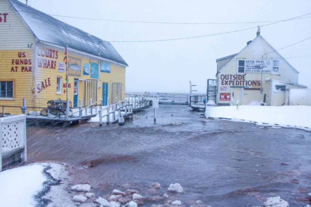
Storm surge event at North Rustico Harbour, Prince Edward Island.
Figure 1.2
Storm surge event at North Rustico Harbour, Prince Edward Island.
Source
Photo courtesy of Don Jardine.
Annual streamflow is projected to increase across most of the region. Studies of the Saint John, Nashwaak, Canaan, Kennebecasis, Restigouche and the Miramichi River watersheds in New Brunswick (El-Jabi et al., 2013), the Pinus River Basin in Labrador (Roberts et al., 2012) and the Sackville River in Nova Scotia (CBCL Consulting Engineers, 2017a) quantify the projected changes. It is difficult to predict how increased annual streamflows will impact the frequency and magnitude of inland flooding, since those events are influenced by a combination of many factors, which tend to differ across the region. For example, in general, inland flooding is caused by:
rain combined with snowmelt and ice jamming in Newfoundland and Labrador;
torrential rainfalls, sudden thaws, and infrastructure failures in Nova Scotia;
extreme precipitation events, often as a result of extratropical storms in Prince Edward Island; and;
rain events, rain-on-snow events, and/or ice jamming in New Brunswick (Burrell, 2011).
1.1.4
Previous work on adaptation
Share
In Atlantic Canada, non-governmental organizations, academic institutions, municipal and provincial governments, and Indigenous communities and organizations have all played a role in past and current work on climate change adaptation. Early work focused on collecting baseline information about regional climate change impacts and supporting climate change risk assessments for different sectors, building collaborative networks, and carrying out Municipal Climate Change Adaptation Plans (e.g., in Nova Scotia). The Atlantic Climate Adaptation Solutions Association (ACASA)—a partnership of the four provincial governments and regional stakeholders—supported collaborative efforts to develop information and tools between 2009 and 2016, primarily for municipalities, to address common climate change impacts (ACASA, n.d.).
These jurisdictions have built on preliminary work to further develop adaptation programs that focus on enhancing capacities, and developing and implementing adaptation plans or strategies, as well as tailored risk assessments and tools. Where unique challenges existed, ACASA also supported projects such as a cost-benefit analysis of transportation adaptation options for the Chignecto Isthmus in the Tantramar region (ACASA, n.d.).Indigenous communities throughout Atlantic Canada have advanced adaptation work. For example, Elsipogtog, L’nuiMenikuk and Esgenoopetitj Mi’gmaq communities have been historically vulnerable to overland flooding, which could intensify with climate change. Through partnering with Indigenous Services Canada, projects are underway in each of these communities to repair flood-damaged homes and infrastructure, while implementing small-scale risk-reduction measures, such as draining improvements, raising flood-prone structures, and doing infilling and grading work to build resiliency (Indigenous Services Canada, 2020; Prairie Climate Centre, 2019a, b).
1.1.5
Chapter approach
Share
This chapter builds on past assessment reports and draws heavily on content provided by local and regional practitioners, non-governmental organizations, consultants, scientists and government. Contributions are based on regional expertise, and lessons learned from successes and challenges, not all of which are available in peer-reviewed journals. The key messages were developed through an iterative prioritization process during workshops and interviews with practitioners and experts. A team of authors stepped forward (responding to broadly extended invitations) to develop the selected key messages further. Indigenous participants in the workshops and meetings emphasized the need to develop a stand-alone key message on Indigenous perspectives, rather than incorporating these into each of the other key messages.
The chapter presents five key messages on themes related to climate change impacts and adaptation in Atlantic Canada. The themes are as follows: risk to infrastructure due to overland flooding and sea-level rise; community health and well-being; Indigenous communities; natural resource industries; and building capacity to adapt to climate change. The knowledge gaps and research needs section discusses other high-priority climate change issues that were identified during the writing process, but where literature was lacking on adaptation approaches (see Section 1.7.1).
1.2
Infrastructure is being threatened by increased flooding and erosion
Share
Climate change is amplifying existing flood risks in Atlantic Canada’s coastal areas and in locations that are prone to overland flooding and erosion. Recognizing the risks, a range of adaptation measures are being implemented, including changes to infrastructure design, such as using engineered protective structures, as well as nature-based approaches to protect the coast.
Coastal and overland flood risks vary across the Atlantic region. The region’s coastline is vulnerable to flooding due to sea-level rise and storm surge, and wave-induced erosion. Major rivers and tributaries can cause overland flooding in the spring—due to snowmelt and rain—and in late autumn and through the winter, when the frozen ground is impervious and agricultural fields are without cover crops. These impacts, if not addressed, can lead to the failure of critical infrastructure systems and an interruption to core services, affecting public safety and threatening the ability of communities to sustainably deliver services. Adaptation to reduce risks from flooding requires the use of approaches that are customized for local circumstances. Common default strategies include raising and/or protecting specific infrastructure in its existing location, but these may have serious limitations in the long term. An increase in the availability, accessibility and precision of hazard maps is enabling the proactive consideration of flood risk in infrastructure design and planning. Alternative approaches, though not yet broadly used, include the use of nature-based approaches to dissipate or slow down water before it affects an asset, as well as managed retreat and relocation.
1.2.1
Introduction
Share
Communities in Atlantic Canada face a substantial risk of coastal and inland flooding due to climate change. Drivers of climate change impacts on the coast—including sea-level rise and storm surges—differ in the relative severity of their impacts—such as erosion and flooding—throughout Atlantic Canada. This reflects differences in the physical environment from one location to another, such as elevation, type of coastal system (e.g., cobble beach, sandstone cliff), wave exposure and other factors (Savard et al., 2016). Changes in sea level are driven by a combination of local, regional, hemispheric and global factors (Atkinson et al., 2016). As a result, historic and projected changes in sea level vary across Atlantic Canada, with many areas projected to experience a rise in sea level that is greater than the global median (see Figure 7.16 in Greenan et al., 2019). More specifically, sea-level rise is projected to be within the range of 75‒100 cm before the end of the 21st century for Newfoundland, Nova Scotia, New Brunswick and Prince Edward Island (Greenan et al., 2019). Sea level is projected to rise only slightly in Labrador due to isostatic rebound (Greenan et al., 2019). The assessment of future changes to sea level continues to evolve with the use of updated observations and climate modelling.
In addition to coastal flood risks, some areas―such as the coastline of the Northumberland Strait in New Brunswick, and Prince Edward Island―are particularly susceptible to coastal erosion due to highly erodible sandstone bedrock and the location of many communities in low-lying coastal areas (Vasseur and Catto, 2008). Coastal erosion is both a long-term and a short-term process. Long-term erosion can be produced by sea-level rise, but also by waves―for example, if the predominant characteristics of the waves change (e.g. in direction). Short-term erosion is caused during storms, so increases in storm activity will increase erosion over the long term (Atkinson et al., 2016). Furthermore, reductions in seasonal sea-ice cover increase the exposure of the coastline to storms, which can result in flooding and accelerated erosion during winter storm events (Greenan et al., 2019; Lemmen et al., 2016).
Overland flooding events in Atlantic Canada are mainly the result of significant rainfall events due to hurricanes; extratropical transitions; autumn storms; ice jams; snowmelt; or a combination of these factors (Newfoundland and Labrador Department of Municipal Affairs and Environment, 2019; Environment and Climate Change Canada, 2010). Extreme daily precipitation is projected to increase in Canada, with stronger projected increases under high emission scenarios and later in the 21st century. For the high emissions scenario (RCP8.5), the projected median increase in the 20-year annual maximum precipitation event for Atlantic Canada is 14% by 2031–2050 and 30% by 2081–2100 (Zhang et al., 2019). As spring melt occurs earlier due to higher temperatures, and rain-on-snow events increase, this will result in a shift towards earlier floods, ice jams and rain-on-snow events (Bonsal et al., 2019), leading to a greater amount of runoff into river and stream systems. Rapid runoff from steep slopes and paved surfaces can result in flooding almost immediately during or after a storm—particularly in areas with thin soil cover, shallow bedrock and steep slopes, which characterize much of Newfoundland and Labrador (PIEVC, 2008). Historic settlement along rivers and the coast places people, infrastructure and services in zones of increasing flood risk. In many cases, development pressures, advances in construction technologies and limited land-use regulation have allowed for unbridled waterfront development in high-risk areas (Cutter et al., 2018).
Coastal and overland flooding has impacts on infrastructure, influencing all aspects of life and socio-economic activity both directly and indirectly. Direct impacts include damage to critical transportation infrastructure between regions that are connected by a single road link, thereby increasing their vulnerability, such as the Chignecto Isthmus connecting New Brunswick to Nova Scotia (Rapaport et al., 2017), the Canso Causeway to Cape Breton Island, the Trans-Canada Highway through southwestern Newfoundland, and the Trans-Canada Highway at Jemseg (MacKinnon, 2019). Work is ongoing in some cases, to identify adaptation approaches to decrease the vulnerability of these transportation links (e.g., Chigneto Isthmus; Parnham et al., 2015).
Some communities along the Wolastoqey (Saint John River), including First Nation communities (e.g., Kingsclear First Nation, St. Mary’s First Nation and Oromocto First Nation) also have critical infrastructure that is vulnerable to climate change impacts. This includes communities with sewage treatment lagoons located in close proximity to the river, where more severe spring thaw resulting from snow and ice melt in rivers and flooding have caused contaminated overflow. This presents health hazards for those communities (Radio-Canada, 2019a; Government of New Brunswick, 2014, Lantz et al., 2012). Communities that are partially or entirely reliant on ferry or bridge service are also subject to weather-related disruptions, affecting areas such as the Kingston Peninsula in New Brunswick and isolated communities in Newfoundland and Labrador.
1.2.2
Adaptation approaches
Share
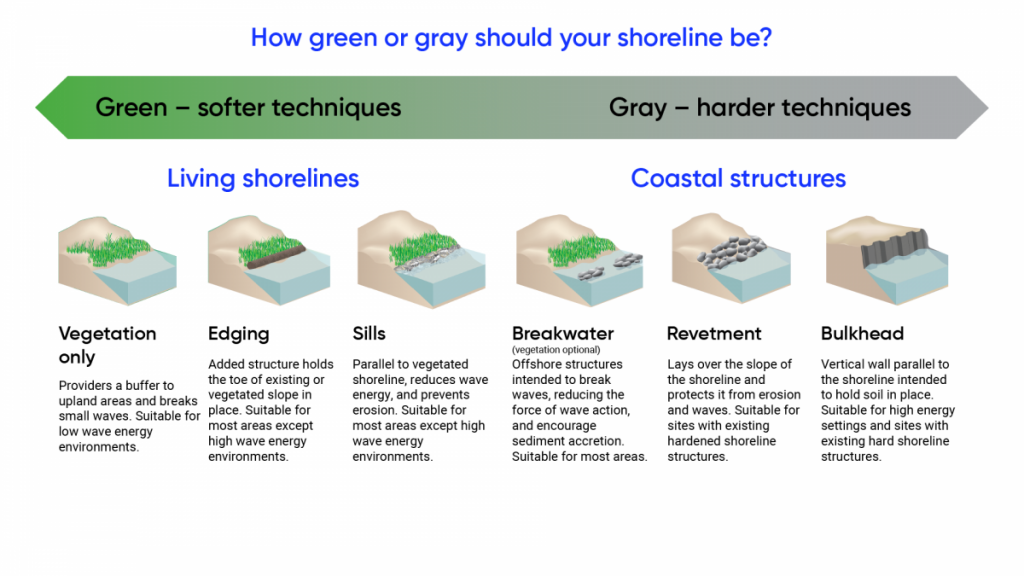
The main strategies in coastal adaptation fall into three categories: protection, accommodation and avoidance/retreat (Lemmen et al., 2016; van Proosdij et al., 2016). Land-use planning, engineering and nature-based approaches provide a variety of options across each of these strategies, although accurate flood hazard tools are necessary to reduce or avoid future flood risks for communities and infrastructure. While the use of “soft” approaches (e.g., shoreline restoration using plants) and “hard” engineering approaches (e.g., building a seawall) are currently the most common approaches to adaptation (seeFigure 1.3), discussions about community relocation are beginning in some areas that are particularly at risk, recognizing that this is rarely a desirable option among residents (Mercer Clarke et al., 2016).
1.2.2.1 Hazard risk assessments
Flood hazard maps, which identify areas that are prone to seasonal or projected flooding, are valuable tools for public outreach and engagement. The information provided by such tools allows communities to conduct detailed vulnerability assessments that consider projected elevations of floodwater, supporting individual citizens, municipalities, planning authorities, infrastructure and utility owners to make well-informed decisions on how best to adapt assets and properties to risks. Up-to-date flood hazard maps, which are essential for decision-makers (Institute for catastrophic Loss Reduction 2019), are under development for some areas in Atlantic Canada.
For example, New Brunswick’s Climate Change Action Plan, Transitioning to a Low-Carbon Economy, recognizes the need to update flood hazard maps to ensure public safety and facilitate land-use planning efforts across the province (Government of New Brunswick, 2016). The province is undertaking both coastal and overland flood risk assessments using updated flood hazard maps. When the data become publicly available, users will be able to easily identify which areas and infrastructure are at risk. Newfoundland has been updating its flood hazard maps since 2005 (Government of Newfoundland and Labrador, n.d.a). Similar projects are underway in both Prince Edward Island and Nova Scotia, where coastal hazard maps and guidance for municipalities on development in floodplains are being developed (Government of Prince Edward Island, 2018).
Many municipalities across Atlantic Canada have updated their flood risk mapping and made changes to municipal plans, regulations and by-laws based on those maps. For example, the Town of Paradise (Newfoundland and Labrador) included the following policy in its most recent Municipal Plan, adopted in 2016, prior to completion of the flood-risk study: “6.4.1 (5) When completed, incorporate the recommendations of a Waterford River Floodplain Study into the Municipal Plan and Development Regulations consistent with provincial floodplain policy” (Town of Paradise, 2016, p. 51). The City of Mount Pearl (Newfoundland and Labrador) has adopted the provincial flood risk mapping and has updated its mapping to show the new flood zones (City of Mount Pearl, n.d.). The city is also studying the Waterford River area in relation to establishing the city centre and how zoning relates to the provincial flood risk mapping (Howell, 2020). These exercises allow for enhanced understanding of potential short- and long-term impacts for specific locations, which helps to inform adaptation measures.
Erosion hazards have been assessed in New Brunswick (Government of New Brunswick, n.d.a), and for the island of Newfoundland based on sensitivity to short-term erosion using a Coastal Erosion Index (Catto, 2011), whereas long-term coastal erosion resulting from relative sea-level rise was assessed using a modification of the Coastal Sensitivity Index (Shaw et al., 1998). Erosion risk assessments were recently conducted in various locations across southern and central Labrador (Catto, 2019), and the Government of New Brunswick provides historical coastal erosion data on its GEONB website geonb.ca.
1.2.2.2 Land-use planning and development control
More stringent land-use planning measures, such as development regulations with minimum horizontal and vertical setbacks, could better direct the placement of new infrastructure away from known flood-risk areas. Despite many municipal climate planning documents, there are still numerous places where land use plans and by-laws either do not exist (for example, in some unincorporated areas of New Brunswick) or do not reflect current and future climate risks (only 34% of New Brunswick municipalities had assessed risk as of 2020; Government of New Brunswick, 2020).
A number of planning-related initiatives at the provincial and municipal scale are designed to advance adaptation action. Nova Scotia’s new Coastal Protection Act limits development, renovations and expansions in vulnerable coastal areas (Nova Scotia Legislature, 2019). In New Brunswick, municipalities facing the greatest coastal hazards were required to complete vulnerability assessments and adaptation plans by 2020. New Brunswick’s 2016 Climate Change Action Plan (Government of New Brunswick, 2016) identifies municipalities as high-risk based on historical events, such as those that caused significant flooding or erosion, damaged infrastructure or property, or affected access or emergency response. New Brunswick’s Climate Action Plan further commits to phasing in the mandatory preparation and implementation of local adaptation plans for those municipalities that also apply for provincial infrastructure funding. These requirements have generated widespread awareness of potential climate change impacts on coastal municipalities. Similarly, in Nova Scotia, communities are obliged to have climate change adaptation plans in place for them to receive funding through the Canada Community-Building Fund, formerly called the federal Gas Tax Fund, and the province has developed a guidebook to support municipalities in this regard (Savard et al., 2016; Fisher, 2011).
1.2.2.3 “Hard” engineering approaches
Throughout Atlantic Canada, private property owners, municipalities and industries almost exclusively use “hard” infrastructure—such as rock or other material (called riprap) and seawalls—to protect their properties against coastal erosion. Although naturalized shorelines are recognized by coastal ecosystem practitioners to be more resilient and more cost-effective over the long term in certain situations (RVCA, 2011), it has been extremely difficult to discourage private property owners from using “hard” engineered approaches (see Figure 1.3). Engineered projects using hard infrastructure may generate more of a sense of security and of being able to withstand climate change impacts. This may act as a deterrent to considering alternatives, such as natural shorelines and natural infrastructure. Larger-scale engineering projects require professional expertise for design, construction (see Case Story 1.1) and maintenance. Periodic re-evaluation of “permanent” structures in light of changing exposure to climate change hazards is also important.
A continuum of green (“soft”) to gray (“hard”) shoreline stabilization techniques.
Figure 1.3
A continuum of green (“soft”) to gray (“hard”) shoreline stabilization techniques.
Source
National Oceanic and Atmospheric Administration, 2015.
Engineering solutions are frequently preferred, and a common default strategy is to raise and/or protect the asset in its existing location. For example, rock armouring combined with the raising of roads may be a practical solution for the short to medium term, if designed in a way that reduces negative impacts on shoreline processes, while meeting functional requirements over its intended lifetime (see Figure 1.4; Leys, 2020). Indigenous Services Canada works with First Nations to support structural mitigation projects, such as dykes and seawalls. After the 2010 tidal surge at Eel River Bar (New Brunswick), a 600-metre seawall was erected to protect some of the most vulnerable areas (Gillis, 2020).
Innovative “hard” engineered solutions that incorporate natural infrastructure can help to preserve local assets, while providing co-benefits such as creating habitat for benthic flora (seeCase Story 1.1; Leys, 2020). Integrated planning processes can be critical to achieving a successful outcome in cases where “hard” engineering approaches alone are insufficient—especially for larger-scale projects (see Case Story 1.1).
Rock revetment, combined with beach openings, used to protect the highway embankment at the entrance to Fundy National Park in Alma, New Brunswick, at low tide.
Figure 1.4
Rock revetment, combined with beach openings, used to protect the highway embankment at the entrance to Fundy National Park in Alma, New Brunswick, at low tide.
Source
Photo courtesy of Doug Watson, Parks Canada.
1.2.2.4 Nature-based approaches
“Nature-based approaches” is used as an umbrella term covering a range of approaches to adaptation that are nature-driven (seeEcosystem Services chapter of the National Issues Report). This includes, among others, nature-based solutions and natural infrastructure. Natural infrastructure is defined as the “strategic use of networks of natural lands, working landscapes and other open spaces to conserve ecosystem values and functions, and to provide associated benefits to human populations” (Allen, 2014). Nature-based infrastructure, often referred to as “green infrastructure” or “soft infrastructure,” includes the use of engineered or human-made systems that resemble natural systems and function naturally. Both natural and nature-based infrastructures provide ecosystem services that enhance resilience (e.g., wetlands contributing to reduced flood risk and enhanced water quality; seeEcosystem Services chapter of the National Issues Report). On a regional scale, the Maritime Natural Infrastructure Collaborative (MNIC) identifies the following challenges and opportunities related to natural infrastructure: building capacity; knowledge and awareness of its importance and use; supporting the development of community engagement tools that can facilitate knowledge integration into land use, watershed and climate change adaptation planning; and working directly with municipalities to implement local adaptation projects (see Case Story 1.2).
The use of nature-based approaches for coastline adaptation in the Atlantic Provinces—such as protective vegetation or wetlands in coastal environments—is less common than engineered structures, in part because these techniques are less familiar and may not be as recognized as effective (van Proosdij, 2021). Implementation of such measures may also require changes in land-use and development regulations to leave open space and preclude building. However, there are promising examples of nature-based approached being used in the region (see Case Stories 1.3; 1.4). A large portion of the natural assets and restored natural infrastructure currently being maintained has benefited from conservation and restoration efforts by non-government organizations (see van Proosdij et al., 2016), or is the result of habitat compensation for construction activities, such as housing developments built by the private sector (Rahman et al., 2019). For example, CB Wetlands and Environmental Specialists Inc. along with Saint Mary’s University restored 320 ha of tidal wetland habitat between 2003 and 2020 (TransCoastal Adaptations, n.d.), while Helping Nature Heal Inc. specializes in naturalizing shorelines that restore biodiversity and shoreline integrity.
Hybrid approaches that combine “hard” and “soft” engineered approaches require multidisciplinary expertise. Input from researchers, practitioners, stakeholders and the public allow scientific knowledge, local knowledge and local observations to be leveraged (see Box 1.1).
1.2.2.5 Participatory action research and adaptation
Participatory action research projects involving researchers, stakeholders and the public have helped municipalities and local service districts develop adaptation plans and strategies (Chouinard et al., 2017, 2015, 2012, 2009, 2008, 2006; Guillemot and Aubé, 2015; Guillemot et al., 2014; Aubé and Kocyla, 2012; Guillemot and Mayrand, 2012). The advantage of such partnerships is that scientific knowledge, combined with local knowledge and observations, can help with co-constructing adaptation plans that are tailored to meet the community’s needs and aspirations. In several cases, this has resulted in a shift away from traditional approaches of using “hard” engineering solutions along coastlines to encouraging the use of hybrid infrastructure solutions, or natural coastal habitats such as dunes, wetlands, and beaches. Some adaptation measures simply involved modification of physical structures, such as raising a bridge to incorporate projected sea-level rise and flood scenarios in Pointe-du-Chêne, New Brunswick, and harmonizing coastal defences in Pointe Carron, New Brunswick (Chouinard et al., 2009). Many adaptation measures utilized new scientific knowledge, such as LiDAR data in New Brunswick’s Acadian Peninsula, and sea-level rise and flooding estimates for New Brunswick coastal sections. Other applied planning tools included vulnerability assessments and climate change adaptation plans (Capozi, 2020; Signer et al., 2014), new zoning and by-laws (e.g., Beaubassin-East zoning by-laws, Southeast Regional Service Commission, 2021); and education and collaboration tools, including a GIS-based community viewer (Lieske et al., 2014a). These various tools and approaches have allowed local decision-makers and adaptation actors to gain capacity and confidence, allowing them to better respond to future challenges (Rahman et al., 2019).
1.2.2.6 Retreat and relocation
Retreat and relocation are coastal adaptation strategies that have been proposed in communities located in the Acadian Peninsula, as well as along the shores of the Gulf of St. Lawrence and Baie des Chaleurs (Projet Adaptation PA, n.d.). The Province of Newfoundland and Labrador has a community relocation program that supports relocation primarily for economic reasons and government services (Government of Newfoundland and Labrador, n.d.b). Response to the relocation option has generally been poor due to the strong sense of place held by many residents and their attachment to their property (EOS Eco-Energy, 2019). For example, residents in Advocate Harbour, Nova Scotia, were not receptive to relocation as an option to address the increasing risk of storm surge flooding (EOS Eco-Energy, 2019). In some cases, refusal to consider relocation as an option creates barriers to further discussions; and measures typically target property owners and not those who rent, which can exacerbate inequities and the overall vulnerability of renters. A recent workshop in New Brunswick examined how practitioners can start conversations around the topic of relocation and explore potential challenges. Participants emphasized that relocation must be voluntary, and be informed by an understanding about risks to people’s land and/or their community (New Brunswick Environmental Network, 2019). There are increasing instances of successful relocation initiatives regionally and nationally that could inform those conversations (see Section 1.7).
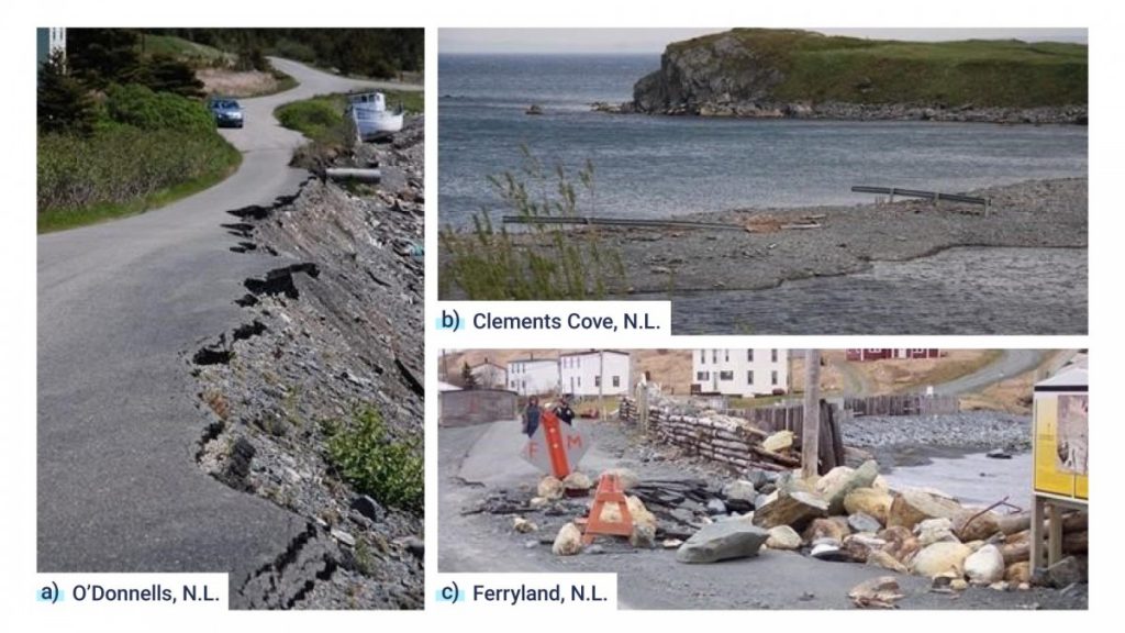
In Ferryland, Newfoundland and Labrador, the road that connects the community to the archaeological site Colony of Avalon crosses a tombolo (a sandy isthmus) that is at risk from large storm surges, especially as sea level continues to rise. Abandonment has not been an option, but existing rock revetment along the road was rebuilt in 2010 after having been destroyed by previous storms, and required subsequent repairs and maintenance (see Figure 1.7a). Although maintenance of this road to serve one house would not seem appropriate (Watton, 2016, the area receives an estimated $2 million in annual tourism revenue, much of which is related to visitation of the archaeological site and the adjacent “lighthouse picnic” attraction, both of which can only be accessed using this road. However, there are some examples of abandoned coastal roads across Atlantic Canada (seeFigure 1.7b; c).
Three examples of vulnerable coastal roads in Newfoundland and Labrador. a) Dead-end road that extends west from the community of O’Donnells, Newfoundland and Labrador, which was eroded following several storm events between 2007 and 2011. The road is no longer being maintained. b) The road that formerly followed the crest of the barachois in Clements […]
Figure 1.7
Three examples of vulnerable coastal roads in Newfoundland and Labrador. a) Dead-end road that extends west from the community of O’Donnells, Newfoundland and Labrador, which was eroded following several storm events between 2007 and 2011. The road is no longer being maintained. b) The road that formerly followed the crest of the barachois in Clements Cove, Newfoundland and Labrador, which has now been abandoned following several wash-over events that took place between 1990 and 2010. The displaced guardrails remain. c) The breakwater that protects the tombolo road in Ferryland, Newfoundland and Labrador, was damaged frequently as a result of storm events between 1989 and 2010, and necessitated periodic reconstruction and maintenance.
Source
Photos courtesy of Norm Catto, Memorial University of Newfoundland.
In New Brunswick and Nova Scotia, foreshore marshes form the primary line of defence for dyke infrastructure, while offshore coastal ecosystems such as dunes, lagoons and sands bars provide natural protection for many coastal communities, land-use activities, and transportation and communication corridors. A recent analysis of dyke vulnerability and flooding concluded that dykes in both provinces have an increased probability of overtopping under the 2100 sea-level rise projection (van Proosdij et al., 2018). The Nova Scotia and New Brunswick Departments of Agriculture are responsible for 364 km of dykes and aboiteaux—water control structures that allow freshwater entering the dyked land to flow out through a flap gate system at low tide, which in turn does not allow salt water to enter the dyked area.
At the global scale, the practice of re-introducing tidal flow—where feasible—to former agricultural dykelands and restoring tidal wetland habitat has been identified as a viable method for adapting to current and future hazards associated with climate change (van Proosdij and Page, 2012). There is also increasing evidence that realignment of coastal protection infrastructure and restoration of tidal wetlands provide long-term and economically sensible solutions to climate change (Sherren et al., 2019; Wollenburg et al., 2018; Vuik et al., 2016; van Proosdij et al., 2014). While previous efforts to restore coastal wetlands in Atlantic Canada have focused primarily on the restoration of resilient and self-sufficient habitats (Bowron et al., 2012), the increasingly tangible impacts of climate change—combined with changing economic landscapes, regulations and land-use practices—have shifted and broadened the objectives of these projects. With limited available resources, guidance is needed to determine where and how dykes should be re-aligned to optimize ecosystem services, maximize adaptation benefits, minimize economic costs, and maintain fertile agricultural land and social, cultural and historic activities. Factors such as the degree of dyke vulnerability, the probability of failure, areas at risk and degree of urgency have helped to support decision making (van Proosdij et al., 2018). This information, combined with an analysis of return on investment, based on the specific assets protected by the dyke structures enabled the Nova Scotia Department of Agriculture to identify 64 km of dyke systems and causeways for improvements (e.g., reinforcement, realignment, salt marsh reversion, etc.) and to leverage $114 million in funding from the National Disaster Mitigation Program in 2019 to support the projects (Government of Canada, 2019). The approach of managed realignment (i.e. setting back the line of maintained defenses to a new line, which is either inland and/or at higher elevation than the original line) was considered alongside other engineering options. Regional capacity to successfully implement managed realignment is growing thorough research programs and monitoring by NGOs, academia and the private sector (Sherren et al., 2019; Wollenburg et al., 2018; Boone et al., 2017; Bowron et al., 2012). Research and collaboration are needed as projects become more complex and involve multiple stakeholders and rights holders.
The Truro area in Nova Scotia is highly prone to recurrent flooding events, with many developed areas located within the natural floodplain. In the 1600 and 1700’s, Acadian settlers built up the natural riverbanks with flood-protection dykes, intended to free productive land for farming purposes. However, during periods of extreme runoff and high river flow, the dykes reduce the ability of the river and floodplain to drain to the ocean, leading to increased flood risk. Sea-level rise is directly affecting the ability of the dykes to protect against flood events from minor storm-surge events (CBCL Consulting Engineers, 2017b).
A comprehensive flood study of the Truro area has identified that realignment of the current dyke system outwards from the riverbanks—restoring a large part of the original floodplain—is a potential measure for reducing flood risk (CBCL Consulting Engineers, 2017b). The North Onslow Floodplain Restoration and Managed Realignment project brought together three Nova Scotia government departments—Department of Agriculture, Department of Transportation and Infrastructure Renewal, and Nova Scotia Environment—in a non-traditional institutional arrangement (Rahman et al., 2019) with CBWES Inc. and Saint Mary’s University. The goal of the project was to design and implement a nature-based climate change adaptation strategy that will eventually restore 90 ha of tidal wetlands (Sherren et al., 2019). This study demonstrates that managed realignment can be implemented, despite complexities within the landscape and competing priorities. It also shows that gaining consensus with those who will be affected by climate change impacts takes time, and benefits from the use of effective visualization materials—including for areas that will be flooded after the dykes are removed—and locally relevant examples of the changing landscape (Sherren et al., 2019).
1.3
Climate change is exacerbating risks to health and well-being
Share
People living in Atlantic Canada are facing significant risks to their physical and mental health and well-being from climate change. Climate change exacerbates health issues associated with existing vulnerabilities in the region, which are influenced by factors such as socioeconomic status, ethnicity, employment and living arrangements. Adaptation measures include public education, vulnerability mapping and actions to address health risks and their underlying factors.
Climate change impacts are adding to existing pressures on community health and well-being. Population vulnerabilities in Atlantic Canada are influenced by the region’s physical geography, demography, economy and settlement patterns. Reducing social inequity makes people and communities more resilient and less vulnerable to many threats, including climate change. Community responses are wide-ranging and include providing education about emergency preparedness, establishing neighbourhood support networks and installing green infrastructure. Public health responses include introducing interventions to lower rates of obesity and cardiovascular disease (both are risk factors for heat-related illness and death), implementing occupational health and safety standards for outdoor workers (e.g., managing exposure to extreme heat), and delivering public education on reducing exposure to extreme heat and to ticks that can lead to Lyme disease. Institutional or corporate responses include undertaking assessments of climate change impacts on health to ensure that policies, programs and protocols support positive health outcomes.
1.3.1
Introduction
Share
Climate change is putting pressure on the population’s physical and mental health (Comeau and Nunes, 2019; Cunsolo Willox et al., 2013). Health risks for populations within the Atlantic Provinces are influenced by climate change impacts associated with the region’s physical geography, climate, demography, existing socioeconomic vulnerabilities, settlement patterns, economy and community design.
1.3.2
Regional characteristics influencing health risks from climate change
Share
1.3.2.1 Physical geography
Flooding is common in Atlantic Canadian communities and is projected to increase, affecting homes, businesses and community infrastructure located in areas at risk of flooding (e.g., Cohen et al., 2019; Greenan et al., 2019; Gunn, 2019; Julian, 2019; Kennedy, 2019; Mercer, 2019). Short-term health impacts related to flooding include physical exposure to cold and wet environments due to loss or damage to homes, as well as exposure to pathogens when sewers back up or overflow, or when flood waters contaminate wells. Longer-term impacts can include negative health outcomes resulting from mold growth and reduced indoor air quality in unremediated and flood-damaged homes (Clayton et al., 2017). Factors such as displacement to a shelter, dealing with lost property and belongings, and returning to a damaged home—followed by cleaning, restoring and, in some cases, rebuilding—take a toll on mental health, both during and after the event (Woodhall-Melnik and Grogan, 2019; Lamond et al., 2015; Carroll et al., 2009). This can be further exacerbated by the possibility of re-flooding in the future, especially in cases where rebuilding takes place in the original flood-prone location. Riverine flooding and sea-level rise can make lowlands uninhabitable and forced relocation diminishes the sense of place, resulting in negative consequences for mental health (Government of Canada, 2020a; Ohl and Tapsell, 2000).
1.3.2.2 Health impacts related to extreme weather
Atlantic Canada is geographically and climatically complex, and human health impacts related to extreme weather events, many of which are expected to increase (e.g., storm events, heat waves) (Bush and Lemmen, 2019; Roy and Huard, 2016), are of particular concern. Severe winter storms can leave people without heating in their homes and without access to water when pumps fail due to the loss of electricity. Build-up of ice on the roads can make travel nearly impossible, leaving many people isolated and low on supplies. This was the case in January 2017, when an ice storm paralyzed a large portion of New Brunswick. More than one third of NB Power’s customers were without electricity for more than 10 days in some parts of the province, causing many emergencies. Without electricity, some homes had no heat and no access to water from their private well; at the peak, 133,000 customers (equating to over 300,000 people) were without power, which is a particular concern for vulnerable communities with few resources (Wagner, 2017). Some people tried to heat their homes using alternative methods, including generators without proper ventilation. Tragically, two people died and 49 people became ill from carbon monoxide poisoning (Wagner, 2017).
While coastal Atlantic Canada benefits from the moderating effects of the ocean, inland areas experience more extreme hot temperatures, making heat waves more likely. Table 1.3 provides examples of heat wave projections for some Nova Scotia communities and for Fredericton, New Brunswick, which show a doubling or tripling of the number of days above 30oC in the near term (2020s) and a four- to six-fold or more increase in the mid-term (2050s) to the long term (2080s) (Zhang et al. 2019; Roy and Huard, 2016; Richards and Daigle, 2011).
Table 1.3
Examples of the annual number of observed and mean projected days above 30˚C in communities within Nova Scotia and New Brunswick
Number of days above 30oC per year
1980s (actual)
2020s (projected)
2050s (projected)
2080s (projected)
Fredericton, N.B. (Saint John River, inland)
9
16
31
53
Kentville, N.S. (Cornwallis Valley, inland)
3.5
8.4
15.4
24.9
Greenwood, N.S. (Annapolis Valley, inland)
6
11.3
19
32.7
Liverpool-Milton, N.S. (Mersey River, 5 km inland)
6.2
11.8
20.4
29.9
Bridgewater, N.S. (La Have River, 15 km inland)
5.8
12.6
21.6
31.4
Charlottetown, P.E.I. (climate station A)
0.7
2.2
5.3
12.3
Projections by Richards and Daigle (2011) were developed from models available for the IPCC AR5 high emissions scenario for New Brunswick, and AR4 medium-high to high emissions scenarios A1B and A2 for the others. Sources: Richards and Daigle, 2011 (Nova Scotia and Prince Edward Island data); Roy and Huard, 2016 (New Brunswick data).
Community and individual factors affect vulnerability to extreme heat exposure. Risk factors for rural areas in Atlantic Canada include an ageing population (i.e., seniors tend to be more at risk to heat-related health impacts); a large proportion of outdoor workers in agriculture, fisheries, forestry and mining (14% of the region’s labour force is employed by these industries; Statistics Canada, 2020b); homeless populations; poorly insulated homes, which are common in older communities; and older community infrastructure in general, which is more susceptible to disruption or damage under extreme heat (e.g., Comeau and Nunes 2019; see also Rural and Remote Communities chapter and Cities and Towns chapter of the National Issues Report).
1.3.2.3 Socioeconomic vulnerability and health
Health outcomes are often linked with socioeconomic vulnerability, which is influenced by factors such as age, income, reliance on government transfer payments, being a new Canadian, language skills, level of education and living arrangement (e.g., single-parent family, senior citizen living alone) (Government of Canada, 2020b). Socioeconomic vulnerability is a major factor in how individuals and groups experience climate change (Preston et al., 2011; Cutter et al., 2008; Cutter and Finch, 2008) and what this experience means for personal and community health and well-being. It is apparent, for example, that older people are at increased risk to adverse health outcomes related to climate change (e.g., in Nova Scotia, Manuel et al., 2015), and thus social vulnerability is an important element of comprehensive risk assessment processes.
1.3.3
Adaptation approaches
Share
Several adaptation initiatives in Atlantic Canada directly or indirectly address the health and well-being of residents to reduce the risks of a changing climate. The following examples highlight different approaches and factors in achieving successful outcomes.
1.3.3.1 Response to the 2017 ice storm in New Brunswick
The impacts of the January 2017 ice storm in rural New Brunswick highlighted the previously documented relationships between environment, community and health (Gillingham et al., 2016). The response to these impacts drew attention to the complexity of provincial government, local government and civil society systems and structures, informal networks, and individual reserves that people draw upon in responding to an emergency of this magnitude. Interdisciplinary analysis of responses to the storm, using a socioecological framework and the social determinants of health, emphasized the importance of environmental, governance and social factors with respect to the vulnerability and resilience of individuals and communities (see Case Story 1.5; Cunsolo Willox et al., 2013; Webb et al., 2010). It also showed how social actors in a region affected by extreme weather succeeded in strengthening the social capital and overall resilience of the community.
It is important that initiatives to strengthen the social capital of communities (Noblet et al., 2016) and to help improve the health of populations (Chriest and Niles, 2018) consider cumulative impacts and ecosystem approaches to health (Charron, 2012). Other initiatives, such as Imaginons la Péninsule acadienne autrement, are leveraging the economic and social potential of renewable energies and food self-sufficiency to make the Acadian Peninsula a more resilient territory. Such inter-sectoral initiatives can serve as catalysts to address social and economic inequalities. A collective, solidarity-based approach has the potential to spur innovative, comprehensive solutions to the climate change risks (Parkes et al., 2016; Prainsack and Buyx, 2016).
1.3.3.2 Vulnerability maps
A key tool for addressing vulnerability to heat-related health impacts includes the creation of vulnerability maps for municipal decision making and analysis of physical design, policy, planning and programming interventions to reduce vulnerability (see Case Story 1.6). For example, vulnerability maps can identify where there are large populations of seniors, who are at increased risk to heat waves, and can help to target public outreach efforts to enhance their resilience, such as by avoiding isolation, staying healthy and hydrated, improving shade with awnings or tree planting, and acquiring air-conditioning (e.g., Gower et al. 2011). It is increasingly important for adaptation initiatives to consider the needs of senior citizens, and to involve them in planning and implementing actions.
1.3.3.3 Understanding social vulnerability
Reducing social inequity makes people and communities more resilient and less vulnerable to many threats, including climate change. Many people and groups are particularly vulnerable to climate change, as it further stresses existing conditions and precarious situations. By better understanding the patterns of social vulnerability in relation to climate change hazards that can occur in an area, provincial and local governments and NGOs can work to reduce the impact of the hazard on vulnerable people and communities (seeCase Story 1.7; Manuel et al., 2016a).
Atlantic Canada has the oldest and most rural population in the country (Government of Nova Scotia, 2017; Statistics Canada, 2015b). Ageing increases the likelihood of other factors—such as respiratory and cardiovascular disease—that can make individuals, and an overall population, more vulnerable to climate change hazards and impacts (Carter et al., 2016; Kenny et al., 2010; Haines et al., 2006). These conditions put people at greater risk from climate change hazards, such as poorer air quality and extreme heat, and can lead to greater reliance on emergency services during events such as storms or heat waves. However, access to emergency services during storms could be compromised due to impacts on roads in flood-prone areas. Older people also tend to have lower incomes, which limits their ability to adequately prepare for and recover from climate emergencies (Statistics Canada, 2019e). Rurality further increases the risk, considering the limited health services in rural areas and the long distances that people often need to travel to access them (seeRural and Remote Communities chapter of the National Issues Report).
1.4
Indigenous experiences inform adaptation in Atlantic Canada
Share
The Mi’kmaq, Wolastoqiyik and Peskotomuhkati Nations of the Wabanaki Confederacy have occupied the Maritimes since time immemorial and have adapted to changes in climate and the environment over countless generations. Partnerships with, and leadership by, local Indigenous peoples are vital to ensuring that the knowledge, perspectives and experiences that they hold from living on the land, inform adaptation in their communities and in the region.
The storytelling culture of the Indigenous peoples in Atlantic Canada has preserved cautionary tales of life in a climate and environment that is changing at a pace dictated by Mother Earth. For instance, historically, Wabanaki peoples had adapted their harvesting practices to cope with the periods of extreme cold, fluctuating climate patterns and short growing seasons associated with the Little Ice Age. The Indigenous people of the Saint John River—the Wolastoqey—successfully cultivated maize by utilizing their knowledge of local microclimates and early harvesting strategies. Wolastoqey were able to manage a broad array of plants as a result of the accumulated knowledge of flood regimes and soil conditions over centuries of living along the Saint John River. However, the arrival of the Industrial age and the subsequent release of greenhouse gases into the atmosphere have accelerated climate change to the point that traditional Indigenous adaptation philosophies are being forced to change and address the new reality.
1.4.1
Introduction
Share
Many Indigenous communities, including the Mi’kmaq communities of Esgenoopetitj and LnuiMenikuk, are strategically located at the mouths of rivers because these areas are biologically productive. They are located on New Brunswick’s eastern shore and the waters of Northumberland Strait, where geologic subsidence is resulting in most coastlines gradually submerging at a rate of several millimeters per year (Zhai et al., 2015). These communities have adapted to climatic and environmental changes since time immemorial. Before European colonization, they moved their seasonal settlements to new locations year after year. When the Crown imposed the reserve system on First Nations people in the early 1800s, the community was no longer free to move with the changing environment and was confined to a land base with a fixed backstop, unable to retreat from the eroding shoreline. Today, the land base of these communities continues to diminish, while sea-level rise is increasing and coastal erosion is accelerating due to reduced winter sea-ice cover and more severe storm surges (Greenan et al., 2019; Savard et al., 2016). As populations grow, they are being squeezed (see Box 1.1). Communities are assessing future climate change impacts and adaptation approaches, while considering how to develop economic opportunities to meet the needs of their growing populations.
1.4.2
Risks to Indigenous communities and culture
Share
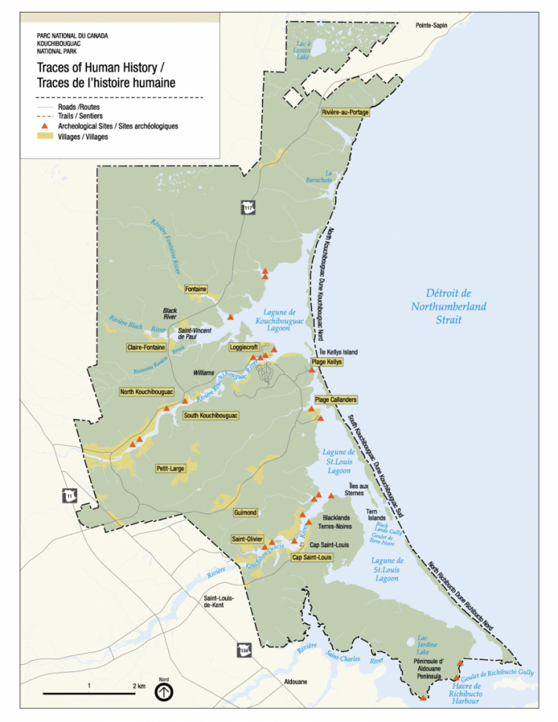
The coastal and inland erosion of archaeological sites is an ongoing issue for Indigenous peoples, with serious political and cultural implications. The loss of archaeological evidence of Indigenous occupation on these lands has potential implications for Indigenous title, land, water and resource claims. Coastal erosion has destroyed archaeological sites and is threatening many existing sites. For example, in Kouchibouguac National Park (KNP), located on the Northumberland Strait about halfway between Esgenoopetitj and LnuiMenikuk, archaeologists have identified a number of archaeological sites along the coast and tidal rivers that are subject to coastal erosion (see Figure 1.13). Damage to key resources arises from many causes, with climate change often amplifying negative impacts. The loss of traditional plants and food sources due to raw sewage, fuels and chemicals leaking into the rivers during flooding events in traditional harvesting areas can have negative effects on Indigenous culture, socioeconomic circumstances, health and well-being. For instance, the New Brunswick Emergency Measures Organization and Department of Health have issued warnings in the past decade that fiddleheads growing in flooded areas may be contaminated and unfit to eat (Fowler, 2018). Fiddleheads are part of a traditional spring diet for Indigenous peoples to help cleanse the body, and they are also a source of income.
The Mi’gmaq community at Ugpi’ganjig, located at the mouth of Eel River on New Brunswick’s Chaleur Bay is an example of a People whose traditional plant and food sources have been affected by contamination. In 1963, the New Brunswick government constructed a dam on Eel River. The primary objective of this project was to establish a water supply for major industries in the area. Secondary objectives were to establish a long-term solution to fish passage and to improve habitat for soft-shelled clams and other shellfish (Government of New Brunswick, n.d.b). In fact, the dam resulted in the contamination of clam beds and the near collapse of salmon, eel and smelt fisheries, all traditional foods for the Mi’gmaq of Ugpi’ganjig. Changes in sediment distribution caused the destruction of sand bars, and increased erosion led to the loss of 60 acres of land, including 15 acres of beachfront property (Eel River Bar First Nation, n.d.a). This left the community vulnerable to the extreme events of storms and high tides (Eel River Bar First Nation, n.d.). One such extreme event occurred on December 6, 2010, when a storm and tidal surge flooded the community, resulting in the evacuation of 10 homes on the First Nation and caused $1,725,000 in damages (Government of New Brunswick, n.d.c). The community responded by reconstructing homes on raised terraces, erecting a concrete sea-wall and purchasing additional land to house its growing population.
Lennox Island, located within Malpeque Bay on the north shore of Prince Edward Island, is home to Lennox Island Mi’kmaq First Nation, which experienced severe flooding from sea-level rise and reduced seasonal sea-ice cover. Most of the Island lies one or two metres above sea level, making it vulnerable to flooding and storm surges (Bissett, 2016). Its sand and sandstone composition makes it highly susceptible to coastal erosion. Rising sea levels and coastal erosion have already reduced the size of the Island from 1,520 acres in 1880 to 1,240 acres in 2010 (Bissett, 2016). Sacred burial grounds, located on a nearby island, have started washing away (Kassam, 2017), as have archaeological records, cultural artifacts and remains of ancestors (see Case Story 1.8; Kassam, 2017; CBC News, 2016; Mitchell, 2015). In addition to losing part of its history and knowledge, the community is facing risks to its Pow Wow grounds, medicinal plant sites, critical infrastructure and residential properties (Fenech and Arnold, 2018).
1.4.3
Adaptation in Indigenous communities
Share
The Indigenous peoples of Atlantic Canada have experienced climate variability such as glaciation, mini ice ages, warm periods and subsequent changes in the environment, and have learned to adapt to changing conditions. The Oxbow site at Metepenagiag First Nation on the Northwest Miramichi River shows proof of continuous occupation for the past 3,000 years (Allen, 2005). Throughout those years, the climate has naturally fluctuated, and Indigenous peoples have responded by adapting. Archaeological excavations of hearth areas at the site show that the most common fish bones found were sturgeon, although this species is rarely seen today in the Red Bank area (Allen, 2005). Through the 19th and 20th centuries, Atlantic salmon were the dominant large fish species in the Miramichi River—in fact, the Miramichi was world-famous for its salmon, and many important people came to the Miramichi Valley to angle for this “King of Fishes.” Up until the 1970s, Atlantic salmon were harvested as a food fishery by the Metepenagiag Mi’kmaq community. The salmon fishery started its steep decline in the late 20th century. The hotter, drier summers experienced over the last few years have further stressed the remaining salmon (see Atlantic Salmon Federation, 2018). The once-thriving sports tourism industry created by salmon angling has diminished to the point that sports anglers must now release the salmon alive. Over the past decade, striped bass have increased dramatically and are replacing Atlantic salmon as the dominant sport fishery (Johnson, 2021).
The community of LnuiMenikuk is adapting to climate change challenges. While their current reserve land is dealing with relative sea level rise, community members are continuing the Mi’kmaq tradition of harvesting from the sea by developing a commercial oyster cultivation industry. This is a challenging industry to develop considering the changing climate and more violent storms. The Indian Island Aquaculture Development Corporation has been growing high quality choice and cocktail oysters since 2007 (Indian Island First Nation, 2015). This is an example where the establishment of a marine protected conservation area could provide a nursery for the oysters.
1.4.4
Indigenous knowledge systems
Share
“Two Eyed Seeing” is a way of learning first proposed by Elder Albert Marshall from the Eskasoni Mi’kmaq Nation. “Two-Eyed Seeing” is learning to see from one eye with the strengths of Indigenous knowledge and ways of knowing, and from the other eye with the strengths of Western (and/or scientific) knowledge and ways of knowing, while learning to use both of these eyes together for the benefit of all (seeBox 1.2; Elder Dr. Albert Marshall, cited in Reid et al., 2020). This concept is widely used by Mi’gmaq Nation groups when conducting research where community knowledge from Elders is sought and used with Western knowledge in the decision-making process. Examples include the Eel River Bar Sea Level Rise study, where the community used a “Two-Eyed Seeing” approach (Gillis, 2020). Mi’gmawe’lTplu’taqnn Inc., which represents nine New Brunswick Mi’gmaq communities, also routinely uses knowledge from its community members in assessing the impact of resource development projects in its territories.
1.5
Forestry, agriculture and fisheries are vulnerable to climate change
Share
Atlantic Canada’s natural resource industries are vulnerable to the impacts of climate change. While examples of adaptation are found in each sector―forestry, agriculture, fisheries and aquaculture―there remains a lack of collaboration amongst stakeholders to reduce risks from climate change.
Foresters, farmers and fishers are interested in understanding the projected climate changes in the short, medium, and long terms to improve their planning and decision making. The challenges presented by climate change for Atlantic Canada’s natural resource industries are numerous, but also divergent among the different resource sectors of forestry, agriculture, fisheries and others.
1.5.1
Introduction
Share
Atlantic Canada’s natural resource industries play a crucial role for the region’s economies, and are vulnerable to the impacts of climate change. The forestry, agriculture and fisheries sectors have made progress on adaptation, and benefited from collaborations between multiple levels of government, practitioners and communities (e.g., Nova Scotia Federation of Agriculture, 2020; Halofsky et al., 2018; Steenberg et al., 2011). Natural resource industries are also considering potential opportunities (e.g., longer growing season, harvesting of newly arrived species), in parallel with negative impacts (e.g., invasive species). A commonality amongst the various natural resource sectors is a strong need for research, monitoring and education, as well as a need for increased progress on action. Rigorous monitoring programs are central to climate change adaptation across all sectors in order to reduce uncertainty and inform the development of new policies and regulations.
1.5.2
Forests
Share
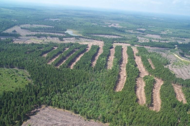
The changing climate will have significant impacts on Atlantic Canada’s forests (seeFigure 1.15; Taylor et al., 2017), with implications for the forest sector, as well as natural areas, including urban forests. Short-term concerns include increases in natural disturbances, such as storm events and pest outbreaks, increased fire risks and invasions by non-native species (MacLean et al., 2021; Taylor et al., 2020). In the longer term, warmer temperatures will lead to shifts in the ranges of tree species. As important species in the region (such as Red Spruce, Black Spruce and Balsam Fir) are projected to decline in growth or abundance (Steenberg et al., 2013a), there will be significant socioeconomic impacts in the forest sector and in forest-dependent communities, including many Indigenous communities. Without action, these impacts could lead to a reduction in timber supply, employment, traditional Indigenous wood products, recreation, aesthetics and other ecosystem services (Ochuodho et al., 2012; see also Ecosystem Services chapter of the National Issues Report). Proactively adapting to these changes helps protect against losses, and also has the potential to generate benefits through new and enhanced wood products and services (Halofsky et al., 2018; Steenberg et al., 2011).
Planned and proactive adaptation is important for the forest sector, in part because of the long time horizons of the sector. Adaptation to date has focused primarily on research and planning to integrate the effects of climate change on forest ecosystem dynamics into modelling used for planning and policy development.
Photo courtesy of Jane Kent, Nova Scotia Department of Lands and Forestry.
Regional integrated assessments have emerged as a key planning tool for Atlantic Canada’s forestry sector. The Maritime Regional Integrated Assessment (MaRIA), which began in 2017, involves provincial governments and forestry industries working together to assess forest vulnerability and integrate climate change considerations into forest management planning frameworks, with an emphasis on forest modelling tools (Taylor, 2021). As part of MaRIA, in New Brunswick, growth and yield curves that were developed using climate change scenarios are being used to project future wood supply (Steenberg, 2021). Additionally, a climate-change-dependent forest succession model will be developed that can be used in the provincial forest planning model to predict the forest regeneration response after harvests. The outcomes support the integration of climate change into the provincial five-year forest management planning cycle. Nova Scotia is similarly developing new protocols to integrate both forest carbon and climate change impacts into its strategic and landscape-level forest modelling and management planning (Steenberg, 2020), while Newfoundland and Labrador has supported similar research (Searls et al., 2021). More recently, the Nova Scotia Department of Lands and Forestry, in collaboration with Nova Scotia Environment and Climate Change, initiated the Climate Adaptation Leadership Program (CALP). The purpose of this program is to develop a climate change adaptation strategy for the province’s Department of Lands and Forestry, with funding from the Province and from Natural Resources Canada through the Building Regional Adaptation Capacity and Expertise (BRACE) program (Natural Resources Canada, 2021).
Other examples of forest management adaptation include intermediate silviculture treatments, like pre-commercial thinning to favour species expected to flourish through a changing climate (Thiffault et al., 2021) and adjusting urban forest management to reflect climate change impacts (seeCase Story 1.10). Assisted species migration and diversification offer yet another approach to adaptation being used in the forestry sector, which includes provenance trials, the planting of genetically improved seedlings, and restoration silviculture (Halofsky et al., 2018).
1.5.3
Agriculture
Share
The net impact of climate change on agriculture in Atlantic Canada will be determined by the balance between opportunities and challenges (Ochuodho and Lantz, 2015). In a project called AgriRisk (Nova Scotia Federation of Agriculture, 2020), the opportunities identified included an extended growing season and the ability to grow higher-value crops, while the challenges included the risks associated with a greater frequency of extreme events, damage to crops and/or infrastructure, uncertainty in global markets, and potential changes in pest spectrum and incidence of disease. In Nova Scotia, a diverse group of researchers through the Nova Scotia Federation of Agriculture (NSFA) carried out a risk assessment focused on the wine grape industry. The goal was to “integrate and make use of the best available data sets and key variables associated with risks along the grape and wine value chain to help contribute to achieving the outcome of a risk-aware grape and wine industry.” The project developed models and interactive climate tools to help users explore current and future climate conditions in the province (Nova Scotia Federation of Agriculture, 2020).
For agriculture, adaptation approaches at the farm level (see Figure 1.16) have focused mainly on reducing non-climatic stressors through management practices. For example, farmers are planting cover crops, changing crop rotation and altering tillage practices to make the soil less vulnerable to erosion (Russell, 2018). Producer decisions are supported by the Alternative Land Use Services (ALUS) Program in Prince Edward Island (ALUS Canada, 2020). The program provides financial incentives to farmers for projects that support sustainable agriculture practices. For example, farmers are compensated for each acre of land used to create soil conservation structures like grassed waterways, terraces or berms. Other farm management adaptation options include flood control, shifting crop varieties, soil management, pest management, artificial cooling in livestock buildings (Arnold and Fenech, 2017; Wall and Smit, 2005), crop diversification and enhancing biodiversity for resilience (Wall and Smit, 2005);
Figure 1.16
Share
a)
b)
1 / 2
Figure 1.16
Agriculture operations on Prince Edward Island.
Source
Photos courtesy of Don Jardine.
1.5.4
Fisheries
Share
The vulnerability of fisheries to climate change is a major socioeconomic and ecological concern in Atlantic Canada, and the need for investment in adaptation has been well identified (Hutchings et al., 2012; Rice and Garcia, 2011). Many rural and coastal communities are highly dependent on fisheries. Given the scale and complexity of marine systems, climate change impacts are highly uncertain and potentially severe (see Sector Impacts and Adaptation chapter of the National Issues Report). Examples of important indicators of marine climate change include rising sea levels, increased ocean temperatures, hypoxia and acidification (Greenan et al., 2019), all of which affect marine ecosystems and fish stocks. Climate change can also increase sedimentation, which can result in fish habitat degradation and population declines (Bernier et al., 2018). More extreme weather also presents technical and safety issues for fishery fleets (Rezaee et al., 2016). In 2017, a lack of available food for right whales in the Bay of Fundy may have contributed to their relocation into the Gulf of St. Lawrence, where the interaction of whales with fixed-gear fisheries led to a significant number of whale deaths, and resulted in the development of gear that is less detrimental to whales (Murison, 2017).
Changes to marine biodiversity present socioeconomic risks for those directly and indirectly connected to the fisheries sector (see Figure 1.17). For example, in the Outer Bay of Fundy, water temperatures have affected the hydrodynamics of ocean currents competing to enter the Bay of Fundy, resulting in an influx of warm Gulf Stream water (Drinkwater et al., 2003). This extreme change in temperature interacts with pH changes and more frequent heavy rainfall events, resulting in severe cumulative impacts on marine biodiversity (Bernier et al., 2018).
Impacts on fisheries infrastructure are another area of concern, with severe storm events placing a tremendous burden on the wharves that the fisheries depend on. Adaptation efforts in the fisheries sector on Grand Manan Island, New Brunswick, for instance, were informed by assessments of future needs under different climate change scenarios (Signer et al., 2014). Improvements to key fisheries infrastructure will help ensure that they can withstand future storm events.
Figure 1.17
Share
a)
b)
1 / 2
Figure 1.17
Lobster fishing traps in the Gulf of St. Lawrence.
Source
Photos courtesy of Don Jardine.
1.5.5
Aquaculture
Share
The marine stages of aquaculture production face a number of challenges related to climate change, including temperatures that approach or exceed the upper thermal limit of species, low water oxygen levels (hypoxia), acidification, more frequent and severe storms, and algal blooms (Reid et al., 2019a, b).
The primary finfish reared in the Atlantic region is the Atlantic salmon (Salmo salar), and several academic/industry research partnerships are addressing challenges from climate change to help the industry to adapt over the next few decades. These include the following: Modules J and K of the Ocean Frontier Institute (“Improving Sustainability and Mitigating the Challenges of Aquaculture” and “Novel Sensors for Fish Health and Welfare,” respectively), the “Mitigating the Impact of Climate-Related Challenges on Atlantic Salmon Aquaculture (MICCSA)” project, the “Addressing the Challenges Faced by Atlantic Salmon at Cold Temperatures” project, and the newly funded Atlantic Salmon Gill Health initiative. The “Mitigating the Impact of Climate-Related Challenges on Atlantic Salmon Aquaculture” (MICCSA) project involves several universities, the Huntsman Marine Science Centre, and industry partners including the Centre for Aquaculture Technology Canada, Somru Biosciences and AquaBounty, Canada. To date, this large project has defined the upper thermal tolerance of Atlantic salmon of the Saint John River stock (Gamperl et al., 2020; Leeuwis et al., 2019), examined the effects of elevated temperature and hypoxia on salmon production (Gamperl et al., 2020), examined pathogen-host interactions as affected by temperature (Zanuzzo et al., 2020), and directly measured Atlantic salmon behavior, distribution and physiology during summer sea-cage conditions (Gamperl et al., 2021). Further, the MICCSA research team is currently working on identifying genetic markers that will allow for the selection of broodstock with enhanced resistance to disease, sea lice and temperature (Beemelmanns et al. 2021 a,b and 2020). The Ocean Frontier Institute has also funded projects at Memorial University (Model J.2) and Dalhousie University (Module K) that are advancing knowledge of how salmon and their populations are affected by adverse environmental conditions (Zanuzzo, 2022; Gerber et al., 2020, 2021; Stockwell et al., 2021). The industry is also exploring technological improvements to increase the depths of their sea cages, in compliance with ISO standards (International Organization for Standardization, 2015) to help ensure that these structures can withstand major storms, which are increasing in intensity as a result of climate change.
The primary molluscan aquaculture species in Atlantic Canada are blue mussels and Eastern oysters, which comprise approximately 35% of all Atlantic Canadian farmed organisms (Statistics Canada, 2021).The impacts of climate change on primary and secondary production have been investigated since the 1990s, and the general consensus is that infrastructure, primary productivity, seed supply, feeding physiology and carrying capacity are changing rapidly in Atlantic Canada and in many coastal regions (e.g., Reid et al. 2019a, b; Foster et al., in preparation). There has been an increase in disease and pest prevalence, an extension of the range of predators, and increasing challenges related to invasive organisms (Best et al., 2017, 2014; Lowen et al., 2016). Recent research has indicated that ocean acidification is affecting natural food supply dynamics, thereby affecting shellfish productivity at the larval and post-larval stages (Kong et al., 2019; Clements et al., 2018; Clements and Hunt, 2017; Clements and Chopin, 2016).
In the aquaculture sector, ocean dynamics, ice cover and changes in seasonal patterns of food supply are being addressed through the adoption of newer green technology by producers, and by using equipment that is storm resistant, well-engineered, better sited, and better suited to withstand the changing coastal conditions in summer and winter (International Organization for Standardization, 2020; Government of Newfoundland and Labrador, 2019). Hatchery production of the main cultivated mollusks (oysters, mussels) has been developed as a risk mitigation measure against spurious natural seed supplies and as a way of selecting strains that will perform better under changing conditions. For instance, three molluscan shellfish hatcheries have been constructed since 2018 in Atlantic Canada―two oyster hatcheries (Bideford Shellfish Hatchery, Prince Edward Island, and Maison BeauSoleil Oyster Hatchery in Neguac, New Brunswick), and one mussel hatchery and nursery in Borden, Prince Edward Island Atlantic Canadian shellfish hatcheries are being employed to reduce dependence on variable natural seed recruitment by producing a more reliable seed source that can grow under the warming climate (Guo et al., 2009). Finally, the use of algae, mollusks and echinoderms in reducing both the impacts of marine finfish farming and climate change is beginning to come to the forefront in Atlantic Canada, across Canada and globally (Clements and Chopin, 2016).
1.6
Building adaptive capacity will strengthen resilience
Share
Adaptive capacity in Atlantic Canada is often constrained by limited human and financial resources. Partnerships and collaboration between different stakeholders—including governments, NGOs, academia and the private sector—are important for driving adaptation in the region. Outreach, public education and effective communication are key for building adaptive capacity in Atlantic Canada.
Adaptive capacity is the ability of individuals, institutions and systems to adapt and thrive to changing conditions. Unfortunately, many institutions in Atlantic Canada—including governments and small communities in rural areas—have limited capacity to engage in climate change adaptation. Access to economic resources, social inequities and other factors can also influence adaptive capacity. Structured processes that identify current or baseline capacity help institutions and systems build their capacity to adapt together.
1.6.1
Introduction
Share
Adaptation to complex challenges, such as climate change, often requires a variety of capacities. This can involve a blend of technical, scientific knowledge and Indigenous knowledge (e.g., climate information, risk assessments, tools for adaptation planning) as well as social and cultural factors (e.g., stakeholder commitment and engagement, leadership, the ability to share information freely, support for risk taking) as well as the financial resources to be able to implement adaptation measures (Forth, 2019; Federation of Canadian Municipalities, 2018; Manuel et al., 2015; Vogel, 2015). These capacities help make adaptation action and success more likely and are considered essential to adaptation. However, enhancing these capacities can also help with a variety of challenges beyond adaptation. As many adaptation efforts are complex and involve different levels of governance, efforts to systematically and intentionally strengthen adaptive capacity in a structured and deliberate manner are often a precursor to effective climate change adaptation (Organisation for Economic Co-operation and Development, 2019; Sherren et al., 2019; Federation of Canadian Municipalities, 2017). Many consider the capacity to adapt as being vested in several organizations or a system, rather than in just one organization, and believe that participation in a network of institutions can collectively build adaptive capacity (Rahman et al., 2019). Investing in adaptive capacity can yield multiple benefits, as institutions and communities with stronger adaptive capacity are better able to thrive in the face of multiple threats and changes, in addition to climate change (Krawchenko et al., 2016; Manuel et al., 2015; Janowitz et al., 2013).
The success of community-based capacity building is linked to awareness raising, outreach, community meetings and other educational programs, which disseminate knowledge about climate change risks and adaptation options, and lead to enhanced social resilience (seeBox 1.3; Noble et al., 2014). Disseminating complex scientific information on climate change to the public can be challenging, and specialized tools to aid communication are often needed to effectively raise public awareness. Strategic research partnerships can facilitate knowledge sharing and provide access to data and advanced technological resources.
It is also recognized that working with and across multiple stakeholder groups has immediate benefits, including developing joint goals, sharing resources and building relationships among all stakeholders (Feist et al., 2020; Plummer et al., 2017). As a result, collaboration contributes to better outcomes, such as a greater appreciation of climate change issues, benefits to the environment, social learning, and improved decision making and governance (see Case Story 1.11).
1.6.2
Adaptation approaches
Share
1.6.2.1 Collaboration and capacity building
Numerous initiatives in Atlantic Canada have included a dimension of capacity building and collaboration within provincial, municipal and regional governments, as well as across different sectors (seeTable 1.5 and Case Story 1.12). While some provinces have climate change action plans that include adaptation actions, there is a need to further build capacity within governments to address climate change impacts and adaptation, and to work effectively with stakeholders.
Widespread collaboration on complex adaptation challenges has also led to the development of solutions that benefit multiple provinces. Provincial governments have supported municipalities in the development of tools, funding for peer-learning projects, and partnerships with NGOs and universities to deliver outreach programs. In New Brunswick, for example, provincial funding is available to community groups, municipalities, First Nations, non-profit organizations and institutions to develop adaptation plans, and to advance sustainable and environmental projects (Government of New Brunswick, n.d.d). Regionally, efforts towards climate change adaptation planning and action have involved pooling resources to effectively and efficiently serve a wider region, thereby avoiding competition between small communities for funds and grants. In all cases, collaboration has been enhanced by encouraging stakeholders to work on common interests and goals.
Table 1.5
Examples of collaborative adaptation initiatives in Atlantic Canada
Project name and location
Description
Natural and Nature-based Climate Change Adaptation Community of Practice
The Natural and Nature-based Climate Change Adaptation Community of Practice is coordinated by the New Brunswick Environmental Network and Nature NB (New Brunswick Environmental Network and Nature NB (2020) and supported by Natural Resources Canada. The Community of Practice (COP) is a multi-sector network that creates planning and education tools, shares information and collaborates to enhance natural and nature-based infrastructure project opportunities among various sectors. COP members work across the Maritimes and other parts of Canada on projects related to nature-based climate solutions and, through events and virtual tools (e.g., website directory, webinars, etc.), have the opportunity to share resources and educate each other about these important topics.
Chignecto Climate Change Collaborative in New Brunswick and Nova Scotia
The Chignecto Climate Change Collaborative (CCCC) was created in January 2013 as a result of research on climate change impacts in the Chignecto region (the narrow strip of land connecting New Brunswick and Nova Scotia) (EOS Eco-Energy, 2021). More than 80 stakeholder groups came together in a workshop hosted by EOS Eco-Energy, a local, environmental non-profit organization, to create a regional climate change adaptation plan (EOS Eco-Energy, 2017, 2013). Today, the collaborative continues to implement the regional plan and offers professional development workshops for its members, networking events and public education. The group also erected a series of educational sea-level rise markers across the Chignecto Isthmus.
Building Asset Management in Newfound and Labrador program
The Building Asset Management in Newfoundland and Labrador initiative—led by Municipalities Newfoundland and Labrador and supported by the Federation of Canadian Municipalities (FCMs) Municipal Asset Management Program (MAMP)—is addressing the needs of smaller communities in Newfoundland and Labrador, where limited resources make climate change-related initiatives challenging (Municipalities Newfoundland and Labrador, 2021). This initiative is cohort-based and focuses on peer learning to make asset management training more accessible, and to build awareness and political will.
Climate change and resilient infrastructure in Newfoundland and Labrador
The Building and Sustaining Infrastructure-Resilience through Targeted Climate Adaptation Training for Professionalsin Newfoundland and Labrador project is building capacity among engineers, planners and municipalities in the province to help inform planning and decision-making activities that will make infrastructure more resilient to climate change (Memorial University of Newfoundland, 2021). The project involves collaboration between Memorial University, the Government of Newfoundland and Labrador, Professional Engineers of Newfoundland and Labrador (PEGNL), Engineers Canada, Municipalities Newfoundland and Labrador and the Newfoundland and Labrador Association of Professional Planners and was supported by Natural Resources Canada.
Building capacity and resilience to climate impacts in key economic sectors in Newfoundland and Labrador.
The Building Capacity and Resilience to Climate Impacts in Key Economic Sectors in Newfoundland and Labrador project is enhancing understanding of climate change impacts across sectors, identifying specific risks and opportunities to ensure that Newfoundland and Labrador is resilient to a changing climate, and building capacity among stakeholders to address risks and opportunities (Natural Resources Canada, 2021). The project involves collaboration between the following: the Government of Newfoundland and Labrador; the Newfoundland and Labrador Federation of Agriculture (NLFA); Fish, Food and Allied Workers; Newfoundland and Labrador Forest Industry Association (NLFIA); Mining Industry NL; and Hospitality Newfoundland and Labrador and was supported by Natural Resources Canada.
New Brunswick Climate Change Action Plan
New Brunswick’s Climate Change Action Plan, Transitioning to a Low-Carbon Economy (Government of New Brunswick, 2016), contains an adaptation strategy supported by actions that aim to build capacity and resilience in communities, business sectors, infrastructure and natural resources by utilizing the province’s long-established NGO network, through the New Brunswick Environmental Network (NBEN).
Educating coastal communities about sea-level rise in Prince Edward Island
The Government of Prince Edward Island is connecting communities to address local climate change impacts by building relationships and supporting the sharing of knowledge about storm-related impacts from past events. As part of the Educating Coastal Communities About Sea-level Rise (ECoAS) Project (Ecology Action Centre, 2018), researchers and graduate students from the University of Prince Edward Island Climate Research Lab facilitated workshops and held presentations in eight communities across the province to increase understanding and awareness about the impacts of sea-level rise, coastal erosion and storm surges.
Regional approach to climate change adaptation in New Brunswick
The northwest region of New Brunswick includes 24 administrative zones of varying size and capacity. In 2017, the Regional Service Commission received provincial funds to develop a single regional adaptation plan (Commission de services régionaux Chaleurs, 2021). The region aims to develop an integrated approach to climate change adaptation by pooling knowledge, assessing common threats at the regional and local scales, and proposing collaborative actions to address identified risks.
New Brunswick Climate Change Adaptation Collaborative
The New Brunswick Climate Change Adaptation Collaborative (NBCCAC) was formed in 2013 in response to an increasing need for capacity building on climate change adaptation within a number of sectors that are facing risks associated with rising sea levels and increased storm events attributed to climate change (New Brunswick Environmental Network, 2018b). As a result, high-risk municipalities in the province are undertaking vulnerability assessments to inform municipal adaptation plans.
Nova Scotia’s Climate Adaptation Leadership Program
Nova Scotia Environment’s Climate Change Division is implementing a Climate Adaptation Leadership Program (Government of Nova Scotia, 2014) to build adaptive capacity within provincial government departments and between these departments and sectoral stakeholders. This approach is based on a learn-by-doing framework in which teams work together to develop and implement climate change adaptation strategies. The structured process includes online and in-person workshops and learning for all team members.
TransCoastal Adaptations: Centre for Nature-Based Solutions
The TransCoastal Adaptations: Centre for Nature Based Solutions at Saint Mary’s University (TransCoastal Adaptations, n.d.) was founded in 2019 to respond to a need for applied experience in implementing coastal restoration projects. Its mission is to support the building of climate-resilient coastal communities and ecosystems by protecting, enhancing and restoring natural processes through innovative research, collaboration and the implementation of nature-based adaptation solutions. It involves integrated partnerships between academia, NGOs, Indigenous groups, and the private and public sector in Nova Scotia and Prince Edward Island.
Projet Adaptation PA
Projet Adaptation PA is a regional project aimed at identifying and implementing measures to reduce current and future impacts of coastal erosion and flooding in communities at risk within New Brunswick’s Acadian Peninsula. The program involves people, communities and organizations working and learning together. The process proposed to each of the communities is as follows: 1) Scenarios and risks; 2) Maps and zoning; 3) Priorities and potential strategies; 4) Evaluation and selection of strategies; and 5) Implementation plans (Projet Adaptation PA, n.d.).
Public outreach and education sessions addressing climate change adaptation occur regularly throughout the Atlantic region and engage a wide variety of public interest groups, including school-age children, community groups, sector-specific professional organizations and special interest groups (e.g., New Brunswick Environmental Network and Nature NB, 2020). Such initiatives are often led by community champions, involve strategic partnerships with research institutions, and receive financial support from local or provincial governments and other funding agencies (see Case Story 1.12). For example, the New Brunswick Environmental Trust Fund (ETF) provides financial support to community groups, municipalities, First Nations, non-profit organizations and institutions to lead projects focusing on climate change education, and communication and outreach activities and programs (Government of New Brunswick, n.d.d).
Support networks for community adaptation have also been established through long-term partnerships with academia (Chouinard & Fauré 2018). These partnerships enhance the visibility of locally developed knowledge and research that focus on local issues (Chouinard and Fauré, 2018). These support networks have been led by academics or individuals who work in the public sector and have climate change expertise (Chouinard and Fauré, 2018).
1.6.2.2 Communication tools and resources
Public outreach opportunities have traditionally helped to educate the public about the science of climate change. More recently, public engagement has shifted towards discussions on community adaptation options, assisted by visual and plain language tools to aid communication. Such tools include flood-risk mapping, computer simulations, plain language brochures, infographics and public workshops (see Table 1.6). A low-tech example is the use of watershed maps showing land-use details, as used through the work of the Maritime Natural Infrastructure Collaborative (MNIC, 2017). These maps can serve as visualization tools when meeting with communities, and they inform discussions about local ecosystem services and threats that may be impacting their delivery (e.g., pollution sources, wetland infill). Without visualization tools, communicating with various stakeholders about ecosystem services, watersheds and nature-based adaptation may be difficult, given the scope and complexity of the topics. Ultimately, these tools have proven to be effective at enhancing communication on climate change risks, engaging stakeholders in discussions about the role that natural areas can play in reducing vulnerability, and enhancing resiliency to climate change (Cheeseman, 2020), as well as being important ways in which individuals gain new knowledge (see Case Story 1.12; Feist et al., 2020). Finally, visualization tools have also proved helpful in communicating complex climate data in a variety of formats to a number of stakeholders, including governments, the private sector and the general public. Some of these tools are referenced below in Table 1.6.
Table 1.6
Examples of communications and data tools and resources in Atlantic Canada
Tools/Data
Description
New Brunswick
Historical coastal erosion data in New Brunswick
Coastal erosion data produced by the Government of New Brunswick, academic institutions and consultants is available for general use. This data includes local, regional and provincial trends in coastline and shoreline displacement (Government of New Brunswick, n.d.a).
Sea-level rise and flooding estimates in New Brunswick
Sea-level rise and flooding scenarios—based on projections of sea-level rise from the IPCC’s Fifth Assessment Report—are available for coastal areas of New Brunswick (Daigle, 2017). These scenarios also consider the regional impacts of vertical land movement, redistribution of land glacier and ice sheet meltwater, dynamic oceanographic effects, land water storage and expected increases in the Bay of Fundy tidal range.
Flood information for New Brunswick
Flood mapping information—including flood lines, extents, flood risk areas and areas that were flooded during particular events—is available for general information purposes (Government of New Brunswick, 2019).
Regional wave run-up study for coastal sections of New Brunswick
Estimates of the potential impacts of wave run-up that can occur during storm surge events along coastal sections of New Brunswick (National Research Council, 2018).
Prince Edward Island
Coastal Impacts Visualization Environment
The Coastal Impacts Visualization Environment (CLIVE; University of Prince Edward Island Climate Research Lab, 2020) is a climate change impacts visualization tool that combines historical erosion data, IPCC model projections of future sea-level rise, aerial imagery and high-resolution digital elevation data to develop analytical visualizations of coastal erosion and future sea-level-rise scenarios.
Prince Edward Island Coastal Property Guide
The Prince Edward Island Coastal Property Guide (DV8 Consulting, 2016) provides information about risks to coastal properties, approaches for reducing risk, development rules and climate change impacts on the coast, including erosion and flooding from sea-level rise.
Prince Edward Island Coastal Hazard Assessments and Maps
Information on coastal hazards—erosion, sea-level rise, storm surge and waves—is available for Prince Edward Island. This data indicates the rate of change (i.e., erosion) in the coastline and the extent and likelihood of temporary (e.g., storm-related) and permanent flooding by 2100. The province-wide reliable and quantitative flood hazard information will be made available through an online map platform. For information on the hazards relating to specific property, a Coastal Hazard Assessment can also be requested fromthe Government of Prince Edward Island’s Coastal Hazard Assessment Online Services (Government of Prince Edward Island, 2021).
Prince Edward Island Coastal Infrastructure Vulnerability Assessment
Coastal hazards are being assessed for the likelihood of occurrence and the potential impacts that they will have on people, communities, structures and the natural environment. This assessment will identify infrastructure and facilities of high vulnerability on Prince Edward Island, to support decision-making relating to emergency management plans and the prioritization of adaptation measures (Parnham, 2021).
Nova Scotia
Agricultural risk assessment tools for the grape and wine industry in Nova Scotia
Developed for the wine and grape industry in Nova Scotia, these tools allow users to explore the probability of certain risk events along the commodity value chain under different climate risk scenarios (Nova Scotia Federation of Agriculture, 2020).
Newfoundland and Labrador
Coastal Change in Newfoundland and Labrador
Online coastal story maps that illustrate connections between the province’s glacial history, coastal landforms and processes, infrastructure, planning, climate change and sea-level rise, and provide resources to planners and decision-makers (Government of Newfoundland and Labrador, n.d.c).
All provinces
Coastal Community Adaptation Toolkit
An interactive and query-based website (ACASA, n.d.), with supporting documents, designed to guide users in identifying locally appropriate adaptation options for managing coastal flooding and erosion. Target audiences are local governments and organizations that support local-level decision making.
Educating Coastal Communities about Sea-Level Rise project website
The website of the Educating Coastal Communities About Sea-Level Rise (ECoAS) Project (Ecology Action Centre, 2018), led by the Ecology Action Centre in Halifax, Nova Scotia, offers numerous resources for communities.
1.7
Moving forward
Share
1.7.1
Knowledge gaps and research needs
Share
Ongoing engagement with practitioners, researchers, NGOs, government employees and consultants has identified knowledge gaps and research needs, specifically in relation to social sciences perspectives on adaptation and social change, including:
Better understanding and addressing viewpoints of Indigenous communities (Fenech and Arnold, 2018; Bartlett, 2017; Canadian Institutes of Health Research, 2015);
Developing monitoring and evaluation tools (Guyadeen et al., 2019; Federation of Canadian Municipalities, 2017; Dupuis et al., 2013; BetterEvaluation, n.d.);
Strengthening research on effective communication methods (Rahman et al., 2019; Lieske et al., 2014b; Nova Scotia Environment and Ecology Action Centre, 2014; University of Prince Edward Island Climate Research Lab, n.d.);
Policy planning and adaptation budgeting (Baird et al., 2016); and
Increasing understanding of how to approach relocation (Barrett, 2020; Power, 2019; Ross, 2017).
While these gaps and needs are not unique to Atlantic Canada, they are considered the most pressing for the region.
1.7.1.1 Applying two-eyed seeing in adaptation
As adaptation planning takes on increasingly complex challenges, the need for holistic and interdisciplinary approaches is becoming clear. Etuaptmumk, or Two-Eyed Seeing, is one approach for fulfilling this need (see Box 1.2) and has been successfully applied in areas other than adaptation. For example, the Institute of Indigenous Peoples’ Health (IIPH) of the Canadian Institute of Health Research (CIHR) balances the different knowledge systems and ways of knowing in all phases of research (i.e., design, analysis, implementation and evaluation of interventions), and provides funding opportunities, including in other collaborative CIHR initiatives (Canadian Institutes of Health Research, 2015). This approach recognizes the limitations of the narrow focus on disease and illness that is common to many Western approaches. Instead, the IIPH approaches health and wellness in a holistic and interconnected manner by addressing the physical, emotional, mental and spiritual health of an individual (Canadian Institutes of Health Research, 2015). By utilizing multiple lenses and understanding existing connections, it will be possible to develop proactive adaptation planning to expand beyond the known, direct and physical impacts within one particular field.
Following are examples of initiatives being carried out: using oral histories to identify climate trends and linking them to climate indices; developing a culturally appropriate method for mapping Mi’kmaq cultural landscape values in Prince Edward Island and using Geographic Information System (GIS) software to assess their vulnerability within the coastal zone; and creating community-based climate monitoring networks using species identification resources in both Mi’kmaq and English (Fenech and Arnold, 2018). However, there remains a need for non-Indigenous organizations to understand the benefits of Two-Eyed Seeing and to implement this approach respectfully, appropriately and effectively in collaboration and conjunction with Indigenous partners. Resources, collaboration with Indigenous groups and documentation of best practices are gaps that can be addressed by building relationships, trust and recognition of leadership.
1.7.1.2 Monitoring and evaluation of adaptation initiatives
As adaptation initiatives grow in scope and complexity, the ability to monitor and evaluate efforts, and assess and improve the efficiency and effectiveness of these initiatives must also grow. While process-based indicators such as “number of total participants” are commonly used, such indicators cannot assess the outcomes of a project (e.g., increased adaptive capacity, enhanced resilience within a system). Approaches such as outcome mapping (i.e., planning, monitoring and evaluating development initiatives in order to bring about sustainable social change) and developmental evaluation (i.e., evaluation that supports ongoing learning and adaptation through iterative, embedded evaluations) are well suited to measuring progress in large multi-stakeholder systems that span multiple scales (BetterEvaluation, n.d.). The benefits of utilizing rigorous monitoring and evaluation techniques in the design, delivery and assessment of climate change adaptation initiatives are currently under study at the UPEI Climate Lab in the areas of agriculture and adaption capacity building in Prince Edward Island (Arnold, 2020).
1.7.1.3 Effective communication
Communication is most likely to be effective when it is customized to the needs and interests of the target audience. The use of visualization techniques to communicate climate change impacts has improved the public’s understanding of anticipated vulnerabilities (see Case Story 1.12; Lieske et al., 2014b; Nova Scotia Environment and Ecology Action Centre, 2014). The ability of visualization tools to collate and distill multiple datasets and communicate abstract concepts in an intuitive manner facilitates interpretation and understanding (University of Prince Edward Island Climate Research Lab, n.d.).
Other types of communication include participatory events that invite audience members to mark a line on the ground using props to indicate anticipated changes to coastlines, and photo simulations that depict expected water levels. Such a study was used to examine the effectiveness of communication between institutional actors within and outside government to build support for a dyke re-alignment and salt marsh restoration project in Truro-Onslow (Rahman et al., 2019). Visual graphs such as interpolated maps of projected climate variables can also help non-technical users to better understand the anticipated changes in our climate. New Brunswick has climate datasets and maps showing projected changes for 29 climate indices (see Northwest Regional Service Commission, 2019). New Brunswick’s climate data sets and maps showcase conditions during the baseline period of 1980–2010, and provide climate projections for 2020, 2050 and 2080. Impacts to the public, apart from those of land loss and infrastructure at risk, are often less visible, and their connections to climate change may be more difficult to understand. Moving forward, effective communication of expected climate change impacts to areas such as biodiversity, agricultural production, public health—and how these impacts affect society—are needed.
1.7.1.4 Policy planning and adaptation budgeting
There are existing knowledge gaps in understanding how climate change affects all areas of governance and society, how policies can be developed to reflect climate change impacts, the costs of adaptation initiatives, and how to effectively build adaptive capacity throughout provincial and municipal governments. Addressing these gaps would help provincial and municipal governments to be proactive in setting policies that consider climate change adaptation. Adaptation funding has often manifested as a higher “cost of doing business” through reactive measures, however studies show that the benefits of planned actions to adapt to climate change in Canada generally exceed the costs (seeCosts and Benefits of Climate Change Impacts and Adaptation chapter of the National Issues Report). Proactive adaptation initiatives are often prompted and co-funded through federal programs that are designed to serve multiple jurisdictions and to meet specific mandates. At the local and regional levels, there are many complex and unique needs that can fall outside of the parameters of such funding opportunities (Baird et al., 2016).
1.7.1.5 Managed relocation
Adaptation has to date been mostly reactive in nature. While awareness of flood and erosion risks influences the investment decisions of some existing and potential property owners, proactive adaptation at a community level, such as relocation, is rare and is only now beginning to be considered more broadly. Atlantic Canada does have some experience with managed relocation. Whereas the 1976 Kouchibouguac expropriation created animosity between residents and government authorities at the time and continues to reverberate negatively (Ross, 2017), the recent relocation of entire communities in Newfoundland seems to have resulted in positive outcomes, although such relocation is primarily promoted because of the provincial costs of service provision (Barrett, 2020). This includes the relocation of Little Bay Islands, in Newfoundland and Labrador, whose residents voted unanimously in favour of relocation, and who will maintain ownership of their houses so they can return for visits (Morin, 2019).
1.7.2
Emerging issues
Share
Consultations, including interviews with practitioners, workshops, and meetings undertaken as part of this chapter have identified several issues of increasing concern for Atlantic Canada. These can be grouped into six categories: an inability to keep pace with the rate of change; limited effectiveness of adaptation initiatives due to external constraints; difficulties in coping with climate change impacts to natural systems; added complexity due to shared responsibilities across jurisdictions; lack of adaptation planning for new development; and advancing the region’s response to Lyme disease.
1.7.2.1 Inability to keep pace with the rate of change
The diversity, intensity, frequency and complexity of climate change impacts are increasing, and adaptation efforts have been unable to keep pace. It is increasingly important that adaptation initiatives be designed and executed in a proactive manner, rather than being reactive. This includes the incorporation of different viewpoints (e.g., Two-Eyed Seeing) and disciplines to increase the reach, rigour and effectiveness of adaptation efforts, as well as equipping policy-makers and decision-makers with the skills and knowledge required to make appropriate decisions informed by public participation, especially those directly affected by climate impacts.
1.7.2.2 Coping with impacts on nature
It has proven difficult to generate public support, plan, design, budget and execute adaptation initiatives to help natural systems adapt to climate change impacts. In addition, the pressure that climate change impacts place on human health and food security is less well understood among the public and policy-makers, compared with impacts on physical infrastructure. The interconnectivities within natural systems and the importance of these ecological relationships are not always self-evident. For example, the increase in metabolism of some insects due to rising temperatures may lead to a population peak earlier in the season, potentially causing a phenological mismatch with the arrival of migratory birds, thereby affecting hatchling growth and development (Nantel et al., 2014). Furthermore, many of the existing initiatives that are mandated to protect and maintain the health of natural systems lack the scope, expertise and resources to address climate change impacts.
1.7.2.3 Added complexity of shared responsibilities across jurisdictions
Adaptation decisions can be challenging, especially where critical infrastructure is relied upon by multiple jurisdictions and failure of this infrastructure could result in cascading economic impacts beyond those of the direct impacts on the at-risk site. For example, the transportation and utilities corridor across the Chignecto Isthmus connects the Halifax Harbour to the rest of Canada and is critical for business continuity across Atlantic Canada. Approximately $24 billion in goods are exported from and $19 billion in goods are imported to Atlantic Canada, with most of these goods being transported through the Isthmus (Parnham et al., 2015). Not only is the infrastructure within this low-lying area of critical importance to trade, disruptions in access can severely impact food security in Newfoundland and Labrador, Prince Edward Island and Nova Scotia, which all rely on this corridor for much of their supplies. While the Chignecto Isthmus spreads over Nova Scotia and New Brunswick geographically, its importance extends to the entire country. This makes adaptation planning more complex. Who should contribute financially to increase the resilience of the Chignecto Isthmus in the face of rising sea levels? Who should decide how fortified this region should be to handle sudden, extreme weather events (e.g., storm surge)? How can provinces that rely on this trade corridor for food security develop alternative plans?
1.7.2.4 Lack of adaptation planning for new development
Over the last decade, a growing number of risk assessments have been carried out for vulnerable coastal locations across Atlantic Canada, and predictive tools have begun to precisely identify low-lying areas at risk of flooding and erosion. These tools are integral in properly implementing land-use planning approaches that will curtail the placement of new infrastructure in known areas of risk. However, many jurisdictions have not yet implemented planning policies or regulations, and continue to issue permits for new development in vulnerable locations. Becoming more climate aware and building capacity to combat the impacts of climate change offer communities and municipalities a unique opportunity to become more sustainable by considering climate change in their decision making and promoting themselves as resilient communities that plan for future conditions and ensure that they are less exposed to risks and remain sustainable. Some municipalities/communities are beginning to see the market value of marketing themselves as communities that are resilient to the impacts of climate change.
1.7.2.5 Lyme disease: An opportunity to leverage across regions
Challenges around Lyme disease are exacerbated by the historical context that has minimized the severity of the disease, poor diagnostics, and hostile and polarized political dialogue inherited from the United States (Stricker and Johnson, 2014). The resulting public health response has consequently suffered from being considered as a low priority and having limited monitoring and oversight and inadequate public education initiatives (Lloyd and Hawkins, 2018). Medical treatment varies by province and physician. In Atlantic Canada, studies on the increasing geographic spread of the tick vector have been published for New Brunswick (Lieske and Lloyd, 2018) and Nova Scotia (McPherson et al., 2017), as has also been done for other areas of the country (Ogden, 2017). Moving forward, genuine and meaningful community-level engagement has the potential to advance both prevention and research initiatives (e.g., Lewis et al., 2018; Lieske and Lloyd, 2018; Stricker and Johnson, 2014).
1.8
Conclusion
Share
Atlantic Canada is vulnerable to climate change impacts due to the cumulative effects of factors that relate to the region’s physical geography, historic settlement patterns, demography, economy and community designs. The low-lying coastal geography of the region, which is subsiding in most locations, makes communities, infrastructure and natural resources particularly vulnerable to coastal impacts due to sea-level rise and a projected increase in the frequency of flood-inducing storm surge events. Social inequities further increase vulnerabilities. Anticipated changes in seasonal temperature extremes and precipitation will also expose Atlantic Canadians to the impacts of more frequent extreme events, such as heat waves, ice storms and seasonal inland flooding.
An ageing and declining population in the rural regions has a reduced social capacity to prepare for and recover from the impacts of climate change. Primary economic resource sectors that rely heavily on marine and coastal infrastructure are also disproportionately vulnerable. However, despite the region’s small size and relatively limited human and financial resources—in comparison to the rest of the country—, adaptation efforts in recent years have been widespread. Local researchers, academics, NGOs and community champions have been resourceful in developing collaborative relationships. By building upon past research and work focused on impact risk assessment, they are shifting their attention from the delivery of adaptation tools, plans and policies to action at the community level through capacity building, nature-based solutions, and public education and outreach.
Common constraints related to the ongoing adaptation efforts discussed in this chapter include a lack of land use and development regulations in small communities (especially in unincorporated areas subject to high development pressures); limited capacity (e.g., human and financial resources, technical ability, etc.) to develop and implement adaptation plans and strategies; and the slow uptake and envisioning of a future that is much more heavily impacted by climate change. Efforts to overcome these challenges include the following:
the use of pilot projects to explore innovative nature-based solutions for shoreline protection;
coordinating multi-stakeholder adaptation efforts in the natural resource industries to reduce risks and leverage opportunities; and
community-based initiatives to promote social adaptation among vulnerable populations, and to recognize both the physical and mental health impacts of extreme weather events.
The collaboration of diverse groups that pool or share resources to effectively and efficiently serve a wider geographic area and broader population has been key to increasing social capacity to adapt to climate change. The public outreach and educational opportunities that have been most effective tend to deliver key messages with context-specific data and examples, making use of visual and plain language tools to aid in communication. Partnerships with local Indigenous communities have strengthened the incorporation of local and Indigenous knowledge into adaptation planning. Collaborations have led to a greater appreciation of climate risks and adaptation options by the public, which benefits not only the environment and social learning, but should also lead to improved decision making and governance.
Atlantic Canada will remain at the frontline of climate change impacts, and strengthened adaptation efforts will be needed. Expanding collaborative efforts and exploring long-term solutions will continue to require different levels of government to play critical roles. Climate change is a shared problem that requires shared responsibility from all groups. Successful adaptation requires complementary action by sectors, businesses, research institutions, NGOs and individuals, given the localized nature of climate change impacts and the need for adaptation.
ACASA [Atlantic Climate Adaptation Solutions Association] (n.d.). Retrieved June 2021, from <https://atlanticadaptation.ca/>
Allen, P. (2005). The Oxbow Site 1984, Metepenagiag Mi’kmaq First Nation, Miramichi, New Brunswick. New Brunswick Manuscripts in Archaeology 39, Archaeological Services, Heritage Branch Culture and Sport Secretariat. Retrieved June 2021, from <https://www2.gnb.ca/content/dam/gnb/Departments/thc-tpc/pdf/Arch/MIA39english.pdf>
Allen, W. (2014). Natural Infrastructure – Investing in Forested Landscapes for Source Water Protection in the United States. World Resources Institute. Retrieved June 2021, from <https://www.wri.org/publication/natural-infrastructure>
Arnold, S. (2020). Personal Communication with Stephanie Arnold, University of Prince Edward Island, Charlottetown, Prince Edward Island, May 25, 2020.
Aubé, M. and Kocyla, B. (2012). Adaptation aux changements climatiques : planification de l’utilisation du territoire à Shippagan, Le Goulet et Bas-Caraquet [Adaptation to climate change: land-use planning in Shippagan, Le Goulet and Bas-Caraquet]. ACASA Projects – Acadian Peninsula – Community support. Coastal Zones Research Institute Inc., 62 p. Retrieved September 2021, from <https://www.rncan.gc.ca/climate-change/impacts-adaptations/le-littoral-maritime-du-canada-face-levolution-du-climat/18391>
Baird, J., Plummer, R., and Bodin, Ö. (2016). Collaborative governance for climate change adaptation in Canada: experimenting with adaptive co-management. Regional Environmental Change, 16(3), 747–758. Retrieved June 2021, from <https://doi.org/10.1007/s10113-015-0790-5>
Barrett, J. (2020). Personal Communication with Josh Barrett, Manager of Planning and Accountability, Department of Tourism, Culture, Industry and Innovation, Government of Newfoundland and Labrador, Saint John’s, Newfoundland and Labrador, May 25, 2020.
Bartlett, C. (2017). Two-Eyed Seeing: An Overview of the Guiding Principle plus some Integrative Science. Presented to Dominique Blanchard, Public and Indigenous Affairs and Ministerial Services Branch, Environment and Climate Change Canada.
Beemelmanns, A., Ribas, L., Anastasiadi, D., Moraleda-Prados, J., Zanuzzo, F.S., Rise, M.L., and Gamperl, A.K. (2020). DNA methylation dynamics in Atlantic salmon (Salmo salar) challenged with high temperature and moderate hypoxia. Frontiers in Marine Science, 7, 1076–1102. Retrieved June 2021, from <https://doi.org/10.3389/fmars.2020.604878>
Beemelmanns, A., Zanuzzo, F.S., Xue, X., Sandrelli, R.M., Rise, M.L., and Gamperl, A.K. (2021a). The transcriptomic responses of Atlantic salmon (Salmo salar) to high temperature stress alone, and in combination with moderate hypoxia. BMC Genomics, 22, 261. Retrieved June 2021, from <https://doi.org/10.1186/s12864-021-07464-x>
Beemelmanns, A., Zanuzzo, F.S., Sandrelli, R.M., Rise, M.L., and Gamperl, A.K. (2021b). The Atlantic salmon’s stress- and immune-related transcriptional responses to moderate hypoxia, an incremental temperature increase, and these challenges combined. G3 Genes|Genomes|Genetics, 11(7). Retrieved June 2021, from <https://doi.org/10.1093/g3journal/jkab102>
Best, K., McKenzie, C.H., and Couturier, C. (2014). Investigating mitigation of juvenile European green crab Carcinus maenas from seed mussels to prevent transfer during Newfoundland mussel aquaculture operations. Management of Biological Invasions, 5(3), 255–262. Retrieved June2021, from <http://dx.doi.org/10.3391/mbi.2014.5.3.09>
Best, K., McKenzie, C.H., and Couturier, C. (2017). Reproductive biology of an invasive population of European green crab, Carcinus maenas, in Placentia Bay, Newfoundland. Management of Biological Invasions, 8(2), 247–255. Retrieved June 2021, from <https://doi.org/10.3391/mbi.2017.8.2.12>
Bonsal, B.R., Peters, D.L., Seglenieks, F., Rivera, A., and Berg, A. (2019). Changes in freshwater availability across Canada; Chapter 6 in Canada’s Changing Climate Report, (Eds.) E. Bush and D.S. Lemmen; Government of Canada, Ottawa, Ontario, 261–342. Retrieved June 2021, from <https://changingclimate.ca/CCCR2019/chapter/6-0/>
Boone, L.K., Ollerhead J., Barbeau, M.A., Beck, A.D., Sanderson, B.G., and McLellan, N.R. (2017). Returning the Tide to Dikelands, Chapter 21 in A Macrotidal and Ice-Influenced Environment: Challenges and Lessons Learned. Coastal Research Library Book Series, Vol 21. Springer Link, 705–749.
Bowron, T., Neatt, N., van Proosdij, D., and Lundholm, J. (2012). Salt Marsh Restoration in Atlantic Canada, Chapter 14 in Restoring Tidal Flow to Salt Marshes: A Synthesis of Science and Management, (Eds.) C.T. Roman and D.M. Burdick. Island Press, 191–210. Retrieved October 2021, from <https://link.springer.com/book/10.5822/978-1-61091-229-7>
Bush, E. and Lemmen, D.S. (Eds.) (2019). Canada’s Changing Climate Report; Government of Canada, Ottawa, ON, 444 p. Retrieved June 2020, from <https://changingclimate.ca/CCCR2019/>
Capozi, R. (2020). Personal Communication with Robert Capozi, Director, Adaptation, New Brunswick Climate Change Secretariat, Department of Environment and Local Government, Government of New Brunswick, November 2020.
Carroll, B., Morbey, H., Balogh, R., and Araoz, G. (2009). Flooded homes, broken bonds, the meaning of home, psychological processes and their impact on psychological health in a disaster. Health and Place, 15(2), 540–547. Retrieved June 2021, from <https://doi.org/10.1016/j.healthplace.2008.08.009>
Carter, T.R., Fronzek, S., Inkinen, A., Lahtinen, I., Lahtinen, M., Mela, H., O’Brien, K., Rosentrater, L.D., Ruuhela, R., Simonsson, L. and Terama, E. (2016) Characterising vulnerability of the elderly to climate change in the Nordic region. Regional Environmental Change, 16(1), 43–58. Retrieved June 2021, from <https://doi.org/10.1007/s10113-014-0688-7>
Charron, D.F. (2012). Ecohealth: Origins and Approach, Chapter 1 in Ecohealth Research in Practice: Innovative Applications of an Ecosystem Approach to Health, (Eds.) D.F. Charron. Springer, New York, NY, USA: International Development Research Centre, Ottawa, Canada. Retrieved October 2021, from <https://idl-bnc-idrc.dspacedirect.org/bitstream/handle/10625/47809/IDL-47809.pdf >
Cheeseman, A. (2020). Personal Communication with Adam Cheeseman, Director of Conservation, Nature NB, Sackville, New Brunswick, December 2020.
Chouinard, O. (2016). Citizen involvement and volunteering along the Acadian coastline: challenges for integrated management and adaptation in the context of climate change, Chapter 7 in Agricultural Adaptation to Climate Change. (Eds.) R.B. Bryant, M.A. Sarr and K. Délusca; Springer, Switzerland, 234 p.
Chouinard, O., Baztan, J. and Vanderlinden, J.-P. (2011). Zones côtières et changement climatique – le défi de la gestion intégrée [Coastal zones and climate change – the challnge of integrated management]. Presses de l’Université du Québec, Québec, 242 p.
Chouinard, O. and Fauré, A. (2018). Policy Guidance Document: Adaptation processes to climate change in the community of Cocagne-Grande-Digue: policy paper. In collaboration with the Pays de Cocagne Sustainable Development Group (GDDPC), the citizens of the Rural Plan Development Committee for the rural community of Cocagne and the Local Service District of Grande-Digue, Retrieved June 2021 from <https://ecopaysdecocagne.ca/images/2018-01-29_Orientation_politique_Chouinard_Faur%C3%A9.pdf>
Chouinard, O., Gauvin, J., Martin, G., Bastien, N., and Mallet, J. (2012). Adaptation to Climate Change in the LSDs of Cocagne and Grande-Digue: Towards a Sustainable Coastal Plan. Coastline Management Booklet. Moncton University in partnership with the Pays de Cocagne Sustainable Development Group (GDDPC) and the Coastal Management Steering Committee of the LSDs of Cocagne and Grande-Digue. Retrieved October 2021 from <https://ecopaysdecocagne.ca/images/publications-bassin-versant/towards-a-sustainable-coastal-plan.pdf>
Chouinard, O., Jolicoeur, S., Martin, G., O’Carroll, S., Bérubé, D., and Kelly, B. (2009). Carron Point: Life in a Coastal Ecosystem. The Carron Erosion Study Team and Steering Committee, Université de Moncton. Retrieved October 2021, from <http://dc.msvu.ca:8080/xmlui/handle/10587/958>
Chouinard, O., Plante, S., and Martin, G. (2006). Engagement des communautés face au changement climatique : une expérience de gestion intégrée à Le Goulet et Pointe-du-Chêne au Nouveau-Brunswick [Community engagement with respect to climate change: an integrated management experience in Le Goulet and Pointe-du-Chêne, New Brunswick]. VertigO, 7(3). Retrieved June 2021, from <https://doi.org/10.4000/vertigo.1912>
Chouinard, O., Plante, S., and Martin, G. (2008). The community engagement process: a governance approach in adaptation to coastal erosion and flooding in Atlantic Canada. Canadian Journal of Regional Science, 31(3), 507–520. Retrieved June 2021, from <https://idjs.ca/images/rcsr/archives/V31N3-CHOUINARD-PLANTE-GILLES.pdf>
Chouinard, O., Plante, S., Weissenberger, S., Noblet, M., and Guillemot, J. (2017). The participative action research approach to climate change adaptation in Atlantic Canadian coastal communities in Climate Change Adaptation in North America: Experiences, Case Studies and Best Practices, (Eds.) W. Leal Filho and J.M. Keenan, Springer, 67–88. Retrieved October 2021, from <https://doi.org/10.1007/978-3-319-53742-9>
Chouinard, O., Rabeniaina, T., and Weissenberger S. (2013). Les apprentissages sur l’aménagement côtier dans deux territoires côtiers du littoral acadien du Nouveau-Brunswick vulnérables à l’érosion et aux inondations [Learnings on coastal planning in two territories of New Brunswick’s Acadian coast vulnerable to erosion and flooding]. Études caribéennes, 26. Retrieved June 2021, from <http://etudescaribeennes.revues.org/6663>
Chouinard, O., Weissenberger, S., and Lane, D. (2015). L’adaptation au changement climatique en zone côtières et l’approche communautaire : études de cas de projets de recherche-action participative au Nouveau-Brunswick (Canada) [Adaptation to climate change in coastal zones and the community approach: case studies of participatory action research (PAR) in New Brunswick Canada]. VertigO, Hors-série 23. Retrieved June 2021, from <https://doi.org/10.4000/vertigo.16642>
Chriest, A. and Niles, M. (2018). The role of community social capital for food security following an extreme weather event. Journal of Rural Studies, 64, 80–90. Retrieved June 2021, from <https://doi.org/10.1016/j.jrurstud.2018.09.019>
Clayton, S., Manning, C.M., Krygsman, K., and Speiser, M. (2017). Mental Health and Our Changing Climate: Impacts, Implications, and Guidance. American Psychological Association and ecoAmerica, Washington, D.C., 70 p. Retrieved June 2021, from <https://www.apa.org/news/press/releases/2017/03/mental-health-climate.pdf>
Clements, J. C. and Chopin, T. (2016). Ocean acidification and marine aquaculture in North America: potential impacts and mitigation strategies. Aquaculture, 9(4), 326–341. Retrieved June 2021, from <https://doi.org/10.1111/raq.12140>
Clements, J.C. and Hunt, H.L. (2017). Effects of CO2-driven sediment acidification on infaunal marine bivalves: A synthesis. Marine Pollution Bulletin, 117(1-2), 6–16. Retrieved June 2021, from <https://doi.org/10.1016/j.marpolbul.2017.01.053>
Clements, J.C, Hicks, C., and Tremblay, R. (2018). Elevated seawater temperature, not pCO2, negatively affects post-spawning adult mussels (Mytilus edulis) under food limitation. Conservation Physiology, 6(1). Retrieved March 2020, from <https://doi.org/10.1093/conphys/cox078>
Climate Atlas of Canada (2019). Climate Atals of Canada, version 2. Retrieved April 2021 from <climateatlas.ca>
Cuthbertson, B. (2015). Stubborn Resistance: New Brunswick Maliseet and Mi Kmaq in Defence of Their Lands. Nimbus Publishing, Halifax, Nova Scotia, Canada, 217 p.
Cohen, S., Bush, E., Zhang, X., Gillett, N., Bonsal, B., Derksen, C., Flato, G., Greenan, B., and Watson, E. (2019). Changes in Canada’s regions in a national and global context, Chapter 8 in Canada’s Changing Climate Report (Eds.) E. Bush and D.S. Lemmen. Government of Canada, Ottawa, Ontario, 424–443. Retrieved June 2021, from <https://changingclimate.ca/CCCR2019/chapter/8-0/>
Cunsolo Willox, A., Harper, S.L., Ford, J.D., Edge, V.L., Landman, K., Houle, K., and Wolfrey, C. (2013). Climate change and mental health: an exploratory case study from Rigolet, Nunatsiavut, Canada. Climatic Change, 121(2), 255–270. Retrieved June 2021, from <https://doi.org/10.1007/s10584-013-0875-4>
Cutter, S.L., Barnes, L., Berry, M., Burton, C., Evans, E., Tate, E., and Webb, J. (2008). A place-based model for understanding community resilience to natural disasters. Global Environmental Change, 18, 598–606. Retrieved June 2021, from <https://doi.org/10.1016/j.gloenvcha.2008.07.013>
Cutter, S.L., Boruff, B.J., and Shirley, W.L. (2003). Social vulnerability to environmental hazards. Social Science Quarterly, 84(2), 242–261. Retrieved June 2021, from <https://doi.org/10.1111/1540-6237.8402002>
Cutter, S.L., Emrich, C.T., Gall, M., and Reeves, R. (2018). Flash Flood Risk and the Paradox of Urban Development. Natural Hazards Review, 19(1). Retrieved June 2021, from <https://doi.org/10.1061/(ASCE)NH.1527-6996.0000268>
Cutter, S.L. and Finch, C. (2008). Temporal and spatial changes in social vulnerability to natural hazards. Proceedings of the National Academy of Sciences, 105(7), 2301–2306. Retrieved June 2021, from <https://doi.org/10.1073/pnas.0710375105>
Drinkwater, K.F., Belgrano, A., Borja, A., Conversi, A., Edwards, M., Greene, C.H., Ottersen, G., Pershing, A.J., and Walker, H. (2003). The Response of Marine Ecosystems to Climate Variability Associated with the North Atlantic Oscillation in The North Atlantic Oscillation: Climatic Significance and Environmental Impact (Eds.) J.W. Hurrell, Y. Kushnir, G. Ottersen and M. Visbeck, American Geophysical Union, 134, 211–234. Retrieved June 2021, from <https://doi.org/10.1029/134GM10>
Duinker, P.N., Ordóñez, C., Steenberg, J.W.N., Miller, K.H., Toni, S.A., and Nitoslawski, S.A. (2015). Trees in Canadian cities: Indispensable life form for urban sustainability. Sustainability, 7(6), 7379–7396. Retrieved June 2021, from <https://doi.org/10.3390/su7067379>
Dupuis, D.R., Baxter, C., and Dobson, J. (2013). Book review: Developmental Evaluation: Applying Complexity Concepts to Enhance Innovation and Use. Journal of Community and Applied Social Psychology, 23(3), 258–260. Retrieved June 2021, from <https://doi.org/10.1002/casp.2116>
Eel River Bar First Nation (n.d.). Ugpi’ganjig Eel River Bar First Nation History, 1972 [Webpage]. Retrieved September 2021, from <https://ugpi-ganjig.ca/ugpiganjig-history/#1972>
El-Jabi, N., Turkkan, N., and Caissie, D. (2013). Regional climate index for floods and droughts using Canadian Climate Model (CGCM3.1). American Journal of Climate Change, 2(2), 106–115. Retrieved June 2021, from <http://dx.doi.org/10.4236/ajcc.2013.22011>
Feist, A., Plummer, R., Baird, J., and Mitchell, S.J. (2020). Examining collaborative processes for climate change adaptation in New Brunswick, Canada. Environmental Management, 65(5), 665–677. Retrieved June 2021, from <https://doi.org/10.1007/s00267-020-01284-7>
Fenech, A. and Arnold, S. (2018). Vulnerability of the Mi’kmaq Confederacy to Climate Change: A Synthesis Report.
Fisher, G. (2011). Municipal Climate Change Action Plan Guidebook. Canada-Nova Scotia Agreement on the Transfer of Federal Gas Tax Funds. Service Nova Scotia and Municipal Relations, Canada-Nova Scotia Infrastructure Secretariat. Retrieved June 2021, from <https://beta.novascotia.ca/documents/municipal-climate-change-action-plan-guidebook>
Forkes, J., Penny, J., and Clean Air Partnership (2010). Mitigating Urban Heat in Canada [e-book]. Urban Heat Island Summit. Clean Air Partnership, Toronto, Ontario, Canada.
Foster, A.M.L, Anderson, M.R., and Couturier, C. (in prep). Interactions of Mussel (Mytilus edulis) Aquaculture and American Lobster (Homarus americanus) in Eastern Newfoundland.
Fowler, S. (2018). Floodwaters may have contaminated much of this season’s fiddleheads. CBC News. Retrieved March 2021, from <https://www.cbc.ca/news/canada/new-brunswick/nb-flood-fiddleheads-unsafe-contaminated-1.4656021>
Francis, R. (2003). The Mi’kmaq Nation and the Embodiment of Political Ideologies: N’kmaq, Protocol and Treaty Negotiations of the Eighteenth Century. MA Thesis, Saint Mary’s University. Retrieved June 2021, from <https://library2.smu.ca/handle/01/22721>
Gamperl, A.K., Ajiboye, O.O., Zanuzzo, F.S., Sandrelli, R., Beemelmanns, A., and Peroni, E. (2020). The impacts of elevated temperature and moderate hypoxia on the production characteristics, cardiac morphology and haematology of Atlantic salmon (Salmo salar). Aquaculture, 519, Article 734874. Retrieved June 2021, from <https://doi.org/10.1016/j.aquaculture.2019.734874>
Gamperl, A.K., Zrini Z.A., and Sandrelli R.M. (2021). Atlantic Salmon (Salmo salar) Cage-Site Distribution, Behavior, and Physiology During a Newfoundland Heat Wave. Frontiers in Physiology. Retrieved June 2021, from <https://doi.org/10.3389/fphys.2021.719594>
Gerber, L., Clow, K. A., and Gamperl, A.K (2021). Acclimation to warm temperatures has important implications for mitochondrial function in Atlantic salmon (Salmo salar). Journal of Experimental Biology, 224. Retrieved June 2021, from <https://doi.org/10.1242/jeb.236257>
Gerber, L., Clow, K.A., Mark, F.C., and Gamperl, A.K. (2020). Improved mitochondrial function in salmon (Salmo salar) following high temperature acclimation suggests that there are cracks in the proverbial ‘ceiling.’ Scientific Reports, 10, Article 21636. Retrieved June 2021, from <https://doi.org/10.1038/s41598-020-78519-4>
Gillingham, M.P., Halseth, G.R., Johnson, C.J., and Parkes, M.W. (2016). The Integration Imperative: Cumulative Environmental, Community and Health Impacts of Multiple Natural Resource Developments. Springer.
Gillis, C.-A. (2020). Identifying Eel River Bar First Nation’s Vulnerability to Sea Level Rise: A Two-Eyed Seeing Approach [Webinar presentation]. Gespe’gewaqMi’gmaq Resource Council and New Brunswick Environmental Council.
Government of Newfoundland and Labrador (n.d.b). Community Relocation – FAQ. Department of Municipal Affairs and Environment, Newfoundland and Labrador. Retrieved June 2020, from <https://www.gov.nl.ca/mae/faq/faq-relocation/>
Government of Newfoundland and Labrador (2017). The Economy 2017. Government of Newfoundland and Labrador, St. John’s, Newfoundland and Labrador, 72p. Retrieved June 2021, from <https://www.economics.gov.nl.ca/E2017/TheEconomy2017.pdf>
Government of Prince Edward Island (2021). Coastal Hazard Assessment – Online Services. Retrieved October 2021, from <https://www.princeedwardisland.ca/en/service/coastal-hazard-assessment>
Greenan, B.J.W., James, T.S., Loder, J.W., Pepin, P., Azetsu-Scott, K., Ianson, D., Hamme, R.C., Gilbert, D., Tremblay, J-E., Wang, X.L., and Perrie, W. (2019). Changes in oceans surrounding Canada, Chapter 7 in Canada’s Changing Climate Report, (Eds.) E. Bush and D.S. Lemmen. Government of Canada, Ottawa, Ontario, 343–423. Retrieved June 2021, from <https://changingclimate.ca/CCCR2019/chapter/7-0/>
Guillemot, J. and Mayrand, E. (2012). Décider et agir : quels apports possibles pour une démarche d’accompagnement des collectivités côtiers face aux changements climatiques à Sainte-Marie-Saint-Raphaël et Shippagan (Nouveau-Brunswick) [Decision-making and actions: what contributions are possible in an initiative to support coastal communities dealing with climate change in Sainte-Marie-Saint-Raphaël and Shippagan, New Brunswick] [Conference presentation]. Coastal Zone Canada, Rimouski, Québec, Canada.
Guillemot, J., Mayrand, E., Gillet, J., and Aubé, M. (2014). La perception du risque et l’engagement dans des stratégies d’adaptation aux changements climatiques dans deux communautés côtières de la péninsule acadienne [The perception of risk and engagement in strategies for climate change adaptation in two coastal communities on the Acadian Peninsula]. VertigO, 14(2). Retrieved June 2021, from <https://doi.org/10.4000/vertigo.15164>
Guillemot, J. and Aubé, M. (2015). L’adaptation aux changements climatiques dans la Péninsule acadienne : rôles d’acteurs clés dans l’émergence d’un dialogue articulé à l’échelle régionale [Adaptation to climate change in the Acadian Peninsula: roles of key players in the emergence of a regional-scale dialogue]. VertigO, Hors-série 23. Retrieved June 2021, from <https://doi.org/10.4000/vertigo.16664>
Guo, X., Wang, Y., Xu, Z., and Yang, H. (2009). Chromosome Set Manipulation in Shellfish in New Technologies in Aquaculture: Improving Production Efficiency, Quality and Environmental Management (Eds). G. Burnell and G. Allen, Woodhead Publishing Limited, Sawston, United Kingdom, 165–194.
Guyadeen, D., Thistlewaite, J., and Henstra, D. (2019). Evaluating the quality of municipal climate change plans in Canada. Climate Change, 152(1), 121–143. Retrieved June 2021, from <https://doi.org/10.1007/s10584-018-2312-1>
Haines, A., Kovats, R.S., Campbell-Lendrum, D., and Corvalan, C. (2006). Climate change and human health: Impacts, vulnerability and public health. Public Health, 120(7), 585–596. Retrieved June 2021, from <https://doi.org/10.1016/j.puhe.2006.01.002>
Halofsky, J.E., Andrews-Key, S.A., Edwards, J.E., Johnston, M.H., Nelson, H.W., Peterson, D.L., Schmitt, K.M., Swanston, C.W., and Williamson, T.B. (2018). Adapting forest management to climate change: The state of science and applications in Canada and the United States. Forest Ecology and Management, 421, 84–97. Retrieved June 2021, from <https://doi.org/10.1016/j.foreco.2018.02.037>
Howell, C. (2020). Personal Communication with Catherine Howell, Manager of Development and Planning, City of Mount Pearl, Newfoundland and Labrador, November 2020.
Hutchings, J.A., Côté, I.M., Dodson, J.J., Fleming, I.A., Jennings, S., Mantua, N.J., Peterman, R.M., Riddell, B.E., and Weaver, A.J. (2012). Climate change, fisheries, and aquaculture: Trends and consequences for Canadian marine biodiversity. Environmental Reviews, 20, 220–311. Retrieved June 2021, from <https://doi.org/10.1139/a2012-011>
ICF (2018). Best Practices and Resources on Climate Resilient Natural Infrastructure. Prepared for Canadian Council of Ministers of the Environment. Retrieved June 2021, from <https://www.preventionweb.net/publications/view/64196>
International Organization for Standardization [ISO] (2015). Online Browsing Platform. Marine Fish Farms – open net cage – design and operation. Retrieved from May 2020, from <https://www.iso.org/obp/ui/#iso:std:iso:16488:ed-1:v1:en>
International Organization for Standardization [ISO] (2020). ISO 16488:2015 – Marine Fish Farms – open net cage – design and operation. Retrieved September 2021, from <https://www.iso.org/standard/56852.html>
Janowitz, M., Waburton, A., and Aitken, M. (2013). A Climate Adaptation Strategy for Community Success: No Matter How the Future Unfolds. A Guide for Incorporating Socioeconomic Information into Municipal Climate Strategy Development Nova Scotia Environment/ACASA.
Jardine, D. (2012). Climate Change Vulnerability Assessment: Souris and Souris West, Prince Edward Island. Prince Edward Island Department of Environment, Labour and Justice. Retrieved June 2021, from <https://atlanticadaptation.ca/en/islandora/object/acasa%3A759>
Johnson, T. 2021. Personal Communication with Tom Johnson, Geographic Information Systems Coordinator, Mi’gmawe’l Tplu’taqnn Inc., August, 2021.
Kenny, G.P., Yardley, J., Brown, C., Sigal, R.J., and Jay, O. (2010). Heat stress in older individuals and patients with common chronic diseases. Canadian Medical Association Journal, 182(10), 1053–1060. Retrieved June 2021, from <https://doi.org/10.1503/cmaj.081050>
Kong, H., Clements, J.C., Dupont, S., Wang, T., Huang, X., Shang, S., Huang, W., Chen, J., Hu, M., and Wang, Y. (2019). Seawater acidification and temperature modulate anti-predator defenses in two co-existing Mytilus species. Marine Pollution Bulletin, 145, 118–125. Retrieved June 2020, from <https://doi.org/10.1016/j.marpolbul.2019.05.040>
Krawchenko, T., Keefe, J., Manuel, P., and Rapaport, E. (2016). Coastal climate change, vulnerability and age-friendly communities: Linking planning for climate change to the age friendly communities’ agenda. Journal of Rural Studies, 44, 55–62. Retrieved June 2021, from <https://doi.org/10.1016/j.jrurstud.2015.12.013>
Lamond, J.E., Joseph, R.D., and Proverbs, J. (2015). An exploration of factors affecting the long term psychological impact and deterioration of mental health in flooded households. Environmental Research, 140, 325–334. Retrieved June 2021, from <https://doi.org/10.1016/j.envres.2015.04.008>
Lantz, V., Trenholm, R., Wilson, J., and Richards, W. (2012). Assessing market and non-market costs of freshwater flooding due to climate change in the community of Fredericton, Eastern Canada. Climatic Change 110, 347–372. Retrieved June 2021, from <https://doi.org/10.1007/s10584-011-0063-3>
Leeuwis, R.J.H., Nash, G.W., Sandrelli, R.M., Zanuzzo, F.S., and Gamperl A.K. (2019). The environmental tolerances and metabolic physiology of sablefish (Anoplopoma fimbria). Comparative Biochemistry and Physiology Part A: Molecular & Integrative Physiology (Special Aquaculture Issue), 231, 140–148. Retrieved in October 2021, from <https://doi.org/10.1016/j.cbpa.2019.02.004>
Lewis, J., Boudreau, C.R., Patterson, J.W., Bradet-Legris, J., and Lloyd, V.K. (2018) Citizen Science and Community Engagement in Tick Surveillance—A Canadian Case Study. Healthcare, 6(1), 22. Retrieved June 2021, from <https://doi.org/10.3390/healthcare6010022>
Leys, V. (2020). Personal Communication with Vincent Leys, Senior Coastal Engineer, CBCL, Halifax, Nova Scotia, May 20, 2020.
Lieske D.J. and Lloyd, V.K. (2018). Combining public participatory surveillance and occupancy modelling to predict the distributional response of Ixodes scapularis to climate change. Ticks and Tick-borne Diseases, 9(3), 695–706. Retrieved June 2021, from <https://doi.org/10.1016/j.ttbdis.2018.01.018>
Lieske, D., Roness, L.A., Phillips, E., and Bornemann, J. (2014a). Tantramar Community Adaptation Viewer Project. Department of Geography and Environment, Mount Allison University. Retrieved June 2021, from <https://arcgis.mta.ca/toolkit/reports/FinalReport_TCAV_(Feb2014).pdf>
Lieske, D., Wade, T., and Roness, L.A. (2014b). Climate change awareness and strategies for communicating the risk of coastal flooding: A Canadian Maritime case example. Estuarine, Coastal and Shelf Science, 140, 83–94. Retrieved June 2021, from <https://doi.org/10.1016/j.ecss.2013.04.017>
Lloyd, V.K. and Hawkins, R.G. (2018). Under-Detection of Lyme Disease in Canada. Healthcare, 6(4), 125. Retrieved June 2021, from <https://doi.org/10.3390/healthcare6040125>
Lowen, B., Deibel, D., McKenzie, C.H., Couturier, C., and DiBacco, C. (2016). Tolerance of early life-stages in Ciona intestinalis to bubble streams and suspended particles. Management of Biological Invasions, 7(2), 157–165. Retrieved June 2021, from <http://dx.doi.org/10.3391/mbi.2016.7.2.03>
MacLean, D. A., Taylor, A. R., Neily, P. D., Steenberg, J. W. N., Basquill, S. P., Quigley, E., Boone, C. K., Oikle, M., Bush, P.G., and Stewart, B. (2021). Natural disturbance regimes for implementation of ecological forestry: A review and case study from Nova Scotia, Canada. Environmental Reviews. Retrieved October 2021, from <https://doi.org/10.1139/er-2021-0042>
Madore, M. (2020). Le rôle des représentations et des capitaux dans l’adaptation au changement climatique : le cas des communautés côtières et forestières acadiennes du Nouveau-Brunswick. [The role of representations and capital in adapting to climate change: the case of Acadian coastal and forest communities of New Brunswick] (French only). Master’s thesis in Environmental Studies. Faculty of Graduate Studies and Research, Université de Moncton.
Manuel, P., Rapaport, E., Guernsey, J., Hooper, K., and Rahman, P. (2016a). Adapting to heat stress in small rural towns: A case study of Middleton, Nova Scotia [Conference presentation]. Livable Cities Forum, Halifax, Nova Scotia, Canada.
Manuel, P., Rapaport, E., Bryce, D., and Kang, B.J. (2016b). The First 10 Metres: Coastal flooding and social vulnerability of coastal populations in Nova Scotia [Conference poster]. Canadian Association of Geographers Annual Meeting, Halifax, Nova Scotia, Canada.
Manuel, P., Rapaport, E., Keefe, J., and Krawchenko, T. (2015). Coastal climate change and aging communities in Atlantic Canada: A methodological overview of community asset and social vulnerability mapping. Canadian Geographer, 59(4), 433–446. Retrieved June 2021, from <https://doi.org/10.1111/cag.12203>
Maritime Natural Infrastructure Collaborative [MNIC]. (2017). Working with Nature. Retrieved May 2020, from <www.planwithnature.ca>
McPherson, M., García-García, A., Cuesta-Valero, F.J., Beltrami, H., Hansen-Ketchum, P., MacDougall D., and Ogden, N.H. (2017). Expansion of the Lyme Disease Vector Ixodes Scapularis in Canada Inferred from CMIP5 Climate Projections. Environmental Health Perspectives, 125(5). Retrieved June 2021, from <https://doi.org/10.1289/EHP57>
National Research Council (2018). Regional wave run-up study for the province of New Brunswick. New Brunswick Department of Environment and Local Government. Technical Report, Ottawa, Ontario. Retrieved June 2021, from <http://142.139.25.105/cgi-bin/koha/opac-detail.pl?biblionumber=40010>
New Brunswick Environmental Network (2018a). Natural Infrastructure Learning Day: Inland Flooding and Erosion Workshop Report. Retrieved June 2021, from <https://bit.ly/2WFG9IZ>
New Brunswick Environmental Network and Nature NB (2020). Natural and Nature-based Climate Change Adaptation Community of Practice. Retrieved June 2021, from <https://www.naturalinfrastructurenb.ca/>
Noble, I.R., Huq, S., Anokhin,Y.A., Carmin, J., Goudou, D., Lansigan, F.P., Osman-Elasha, B., and Villamizar, A. (2014). Adaptation Needs and Options, Chapter 14 in Climate Change 2014: Impacts, Adaptation, and Vulnerability. Part A: Global and Sectoral Aspects. Contribution of Working Group II to the Fifth Assessment Report of the Intergovernmental Panel on Climate Change. (Eds.) C.B. Field, V.R. Barros, D.J. Dokken, K.J. Mach, M.D. Mastrandrea, T.E. Bilir, M. Chatterjee, K.L. Ebi, Y.O. Estrada, R.C. Genova, B. Girma, E.S. Kissel, A.N. Levy, S. MacCracken, P.R. Mastrandrea, and L.L. White. Cambridge University Press, Cambridge, United Kingdom and New York, NY, USA, 833–868. Retrieved October 2021, from <https://www.ipcc.ch/site/assets/uploads/2018/02/WGIIAR5-Chap14_FINAL.pdf>
Noblet, M., Guillemot, J., and Chouinard, O. (2016). Role of collective action and social capital in the process of adaptation to climate change in coastal areas – Comparison of two case studies in New Brunswick (Canada). Développement durable et territoires, 7(2). Retrieved February 2019, from <https://journals.openedition.org/developpementdurable/11297>
Northwest Regional Service Commission (CSRNO) (2019). Climate Mapping Tools. Retrieved September 2021, from < https://csrno.ca/climat/>
Nova Scotia Federation of Agriculture (2020). Risk Proofing Nova Scotia Agriculture: A Risk Assessment System Pilot. AgriRisk. Retrieved June 2021, from <https://nsfa-fane.ca/projects/agririsk/>
Ochuodho, T., Lantz, V., Loyd-Smith, P., and Benitez, P. (2012). Economic impacts of climate change and adaptation in Canadian forests: A CGE modeling analysis. Forest Policy and Economics, 25, 100–112. Retrieved June 2021, from <https://doi.org/10.1016/j.forpol.2012.08.007>
Ochuodho, T. and Lantz, V. (2015). Economic impacts of climate change on agricultural crops in Canada by 2051: A global multi-regional CGE model analysis. Environmental Economics, 6(1), 113–125.
Ogden, N. H. (2017). Climate change and vector-borne diseases of public health significance. FEMS Microbiology Letters, 364(19). Retrieved June 2021, from <https://doi.org/10.1093/femsle/fnx186>
Organisation for Economic Co-operation and Development [OECD] (2019). Responding to Rising Seas: OECD Country Response to Tackling Coastal Risks. OECD Publishing, Paris. Retrieved June 2021, from <https://doi.org/10.1787/9789264312487-en>
Ostrom, E. (2008). Governing the Commons: The Evolution of Institutions for Collective Action (22nd printing.). Cambridge University Press, Cambridge, United Kingdom.
Parkes, M.W., Harmsworth, G., Bunch, M., Emmons, S., and Brook, M. (2016). Integrative approaches to environment, community and health: Innovations and connections across local, Indigenous and geospatial knowledge. EcoHealth in Action Webalogue Series. Retrieved June 2021, from <https://ecohealthkta.net/integrative-approaches-webalogue/>
Parnham, H., Arnold, S., and Fenech, A. (Eds.) (2015). Using cost benefit analysis to evaluate climate change adaptation options in Atlantic Canada. Report submitted to the Climate Change Impacts and Adaptation Division, Natural Resources Canada. Retrieved June 2021, from <http://atlanticadaptation.ca/en/islandora/object/acasa%3A779>
Parnham, H. (2021). Personal Communication with Hope Parnham, Senior Climate Change Policy Advisor, Department of Environment, Energy and Climate Action, Government of Prince Edward Island, Charlottetown, Prince Edward Island.
Peltier, C. (2018). An Application of Two-Eyed Seeing: Indigenous Research Methods With Participatory Action Research. International Journal of Qualitative Methods, 17, 1–12. Retrieved June 2021, from <https://doi.org/10.1177/1609406918812346>
Plummer, R., Baird, J., Dzyundzyak, A., Armitage, D., Bodin, Ӧ., and Schultz, L. (2017). Is adaptive co-management delivering? Examining relationships between collaboration, learning and outcomes in UNESCO biosphere reserves. Ecological Economics, 140, 79–88. Retrieved June 2021, from <https://doi.org/10.1016/j.ecolecon.2017.04.028>
Prainsack, B. and Buyx, A. (2016). Thinking ethical and regulatory frameworks in medicine from the perspective of solidarity on both sides of the Atlantic. Theoretical Medicine and Bioethics, 37(6), 489–501. Retrieved June 2020, from <https://doi.org/10.1007/s11017-016-9390-8>
Prairie Climate Centre (2019b). Climate change and Canada’s cities. The Climate Atlas of Canada (version 2, July 10, 2019). Retrieved March 2020, from <https://climateatlas.ca/topic/cities>
Preston, B.L., Yuen, E.J., and Westaway, R.M. (2011). Putting vulnerability to climate change on the map: A review of approaches, benefits, and risks. Sustainability Science, 6(2), 177–202. Retrieved June 2021, from <https://doi.org/10.1007/s11625-011-0129-1>
Projet Adaptation PA (n.d.). Climate change is affecting our lives: We must adapt now. Retrieved May 2020, from <https://www.adaptationpa.ca/en/>
Rahman, H.M.T., Sherren, K., and van Proosdij, D. (2019). Institutional Innovation for Nature-Based Coastal Adaptation: Lessons from Salt Marsh Restoration in Nova Scotia, Canada. Sustainability 11(23), 6735. Retrieved June 2021, from <https://doi.org/10.3390/su11236735>
Reid, A.J., Eckert, L.E., Lane, J.-F., Young, N., Hinch, S.G., Darimont, C.T., Cooke, S.J., Ban, N.C., and Marshall, A. (2020). “Two-Eyed Seeing”: An Indigenous framework to transform fisheries research and management. Fish and Fisheries, 22(2), 243–261. Retrieved June 2021, from <https://doi.org/10.1111/faf.12516>
Reid, G. K., Gurney-Smith, H.J., Marcogliese, D.J., Knowler, D., Benfey, T., Garber, A.F., Forster, I., Chopin, T., Brewer-Dalton, K., Moccia, R.D., Flaherty, M., Smith, C.T., and De Silva, S. (2019a). Climate change and aquaculture: Considering biological response and resources. Aquatic Environment Interactions, 11, 569–602. Retrieved June 2021, from <https://doi.org/10.3354/aei00332>
Reid, G.K., Gurney-Smith, H.J., Flaherty, M., Garber, A.F., Forster, I., Brewer-Dalton, K., Knowler, D., Marcogliese, D.J., Chopin, T., Moccia, R.D., Smith, C.T., and De Silva, S. (2019b). Climate change and aquaculture: Considering adaptation potential. Aquatic Environment Interactions, 11, 603–624. Retrieved June 2021, from <https://doi.org/10.3354/aei00333>
Rezaee, S., Pelot, R., and Finnis, J. (2016). The effect of extratropical cyclone weather conditions on fishing vessel incidents’ severity level in Atlantic Canada. Safety Science, 85, 33–40. Retrieved June 2021, from <https://doi.org/10.1016/j.ssci.2015.12.006>
Rice, J.C. and Garcia, S.M. (2011). Fisheries, food security, climate change, and biodiversity: Characteristics of the sector and perspectives on emerging issues. ICES Journal of Marine Science, 68, 1343–1353. Retrieved June 2021, from <https://doi.org/10.1093/icesjms/fsr041>
Richards, W. and Daigle, R. (2011). Scenarios and Guidance for Adaptation to Climate Change and Sea Level Rise [Conference presentation]. Climate Change: Getting Ready Conference, Halifax, Nova Scotia, Canada. Retrieved June 2021, from <https://atlanticadaptation.ca/en/islandora/object/acasa%3A660>
Roberts, J., Pryse-Phillips, A., and Snelgrove, K. (2012). Modeling the potential impacts of climate change on a small watershed in Labrador, Canada. Canadian Water Resources Journal, 37(3), 231–251. Retrieved June 2021, from <https://doi.org/10.4296/cwrj2011-923>
Searls, T., Zhu, X., McKenney, D. W., Mazumder, R., Steenberg, J., Yan, G., and Meng, F.R. (2021). Assessing the influence of climate on the growth rate of boreal tree species in northeastern Canada through long-term permanent sample plot data sets. Canadian Journal of Forest Research, 51(7), 1039–1049.
Sherren, K., Bowron, T., Graham, J.M., Rahman, H.M.T., and van Proosdij, D. (2019). Coastal infrastructure realignment and salt marsh restoration in Nova Scotia, Canada, Chapter 5 in Responding to Rising Seas: OECD Country Approaches to Tackling Coastal Risks. OECD Publishing: Paris, France, 111–135. Retrieved June 2021, from <https://doi.org/10.1787/9789264312487-en>
Signer, K., Reeder, K., and Killorn, D. (2014). Community Vulnerability Assessment of Climate Change and Variability Impacts in Charlotte County, New Brunswick. St. Croix Estuary Project Inc. and Eastern Charlotte Waterways Inc. Retrieved June 2021, from <https://swnbclimate.ca/wp-content/uploads/2020/05/ECW_CCCVA_Final_2014.pdf>
Statistics Canada (2019d). Table: 32-10-0012-01. Number of persons in the total population and the farm population, for rural areas and population centres classified by sex and age. Retrieved March 2019, from <https://www150.statcan.gc.ca/t1/tbl1/en/cv.action?pid=3210001201>
Statistics Canada (2020a). Employment by industry, three month moving average, unadjusted for seasonality, provinces, and economic regions (x 1,000) Table 14-10-0091-01. Retrieved May 2020, from <https://www150.statcan.gc.ca/t1/tbl1/en/tv.action?pid=1410009101>
Steenberg, J.W.N., Duinker, P.N., and Bush, P.G. (2011). Exploring adaptation to climate change in the forests of central Nova Scotia, Canada. Forest Ecology and Management, 262(12), 2316–2327. Retrieved June 2021, from <https://doi.org/10.1016/j.foreco.2011.08.027>
Steenberg, J. W.N., Duinker, P. N., and Bush, P. G. (2013a). Modelling the effects of climate change and timber harvest on the forests of central Nova Scotia, Canada. Annals of Forest Science, 70, 61–73.
Steenberg, J.W.N., Duinker, P.N. and Charles, J.D. (2013b). The neighbourhood approach to urban forest management: The case of Halifax, Canada. Landscape and Urban Planning, 117, 135–144. Retrieved June 2021, from <https://doi.org/10.1016/j.landurbplan.2013.04.003>
Steenberg, J. (2020). Personal Communication, Government of Nova Scotia, Halifax, Nova Scotia, May, 2020.
Steenberg, J. (2021). Personal Communication with James Steenberg, Resource Analyst, Department of Lands and Forests, Government of Nova Scotia, Halifax, Nova Scotia, March 2021.
Stockwell, C.L., Filgueira, R., and Grant, J. (2021). Determining the Effects of Environmental Events on Cultured Atlantic Salmon Behaviour Using 3-Dimensional Acoustic Telemetry. Frontiers in Animal Science. Retrieved June 2021, from <https://doi.org/10.3389/fanim.2021.701813>
Stricker, R.B. and Johnson, L. (2014). Lyme Disease: Call for a “Manhattan Project” to Combat the Epidemic. PLoS Pathogens, 10(1), Article e1003796. Retrieved June 2021, from <https://doi.org/10.1371/journal.ppat.1003796>
Taylor, A. R., MacLean, D. A., Neily, P. D., Stewart, B., Quigley, E., Basquill, S. P., Boone, C. K., Gilby, D., and Pulsifer, M. (2020). A review of natural disturbances to inform implementation of ecological forestry in Nova Scotia, Canada. Environmental Reviews, 28(4), 387–414. Retrieved June 2021, from <https://doi.org/10.1139/er-2020-0015>
Taylor, A.R., Boulanger, Y., Price, D.T., Cyr, D., McGarrigle, E., Rammer, W., and Kershaw Jr, J.A. (2017). Rapid 21st century climate change projected to shift composition and growth of Canada’s Acadian Forest Region. Forest Ecology and Management, 405, 284–294. Retrieve June 2021, from <https://doi.org/10.1016/j.foreco.2017.07.033>
Thiffault, N., Raymond, P., Lussier, J. M., Aubin, I., Royer-Tardif, S., D’Amato, A.W., Doyon, F., Lafleur, B., Perron, M., Bousquet, J., Isabel, N., Carles, S., Lupien, P., and Malenfant, A. (2021). Adaptive Silviculture for Climate Change: From Concepts to Reality Report on a symposium held at Carrefour Forêts 2019. The Forestry Chronicle, 97(1), 13-27. Retrieved October 2021, from <https://doi.org/10.5558/tfc2021-004>
TransCoastal Adaptations (n.d.). Centre for Nature-Based Solutions. Retrieved May 2020, from <www.transcoastaladaptations.ca>
University of Prince Edward Island Climate Research Lab (n.d.). Coastal Impacts Visualization Environment. Retrieved May, 2020 from <http://projects.upei.ca/climate/clive>
van Proosdij, D. and Page, S. (2012). Best Management Practices for Climate Change Adaptation in Dykelands: Recommendations for Fundy ACAS sites. Final report submitted to Atlantic Climate Adaptation Solutions Association [ACASA], 151 p. Retrieved June 2021, from <https://atlanticadaptation.ca/fr/islandora/object/acasa%253A279>
van Proosdij D., MacIsaac, B., Christian, M., and Poirier, E. (2016). Adapting to Climate Change in Coastal Communities of the Atlantic Provinces, Canada: Land Use Planning and Engineering and Natural Approaches. Part 1 – Guidance for selecting adaptation options. Prepared for Atlantic Climate Adaptation Solutions Association [ACASA] No. AP291: Coastal Adaptation Guidance – Developing a Decision Key on Planning and Engineering Guidance for the Selection of Sustainable Coastal Adaptation Strategies. Retrieved June 2021, from <https://atlanticadaptation.ca/en/islandora/object/acasa%3A786>
van Proosdij, D. (2021). Personal Communication with Danika van Proosdij, Professor, Geography and Environmental Studies, St. Mary’s University, Halifax, Nova Scotia, August 2021.
Vogel, B.A. (2015). Adapting to Climate Change: The Case of Multi-level Governance and Municipal Adaptation Planning in Nova Scotia, Canada. PhD Dissertation, University of Western Ontario. Retrieved June 2021, from <https://ir.lib.uwo.ca/etd/3674>
Vuik, V., Jonkma, S.N., Botsje, D.W., and Suzuki, T. (2016). Nature-based flood protection: The efficiency of vegetated foreshores for reducing wave loads on coastal dikes. Coastal Engineering, 116, 42–56. Retrieved June 2021, from <https://doi.org/10.1016/j.coastaleng.2016.06.001>
Wall, E. and Smit, B. (2005). Climate change adaptation in light of sustainable agriculture. Journal of Sustainable Agriculture, 27, 113–123. Retrieved June 2021, from <https://doi.org/10.1300/J064v27n01_07>
Watton, E.C. (2016). Coastal geomorphology, processes and erosion at the tourist destination of Ferryland, Newfoundland and Labrador. Master’s Thesis, Memorial University. Retrieved September 2021, from <https://research.library.mun.ca/12076/>
Webb, J.C., Mergler, D., Parkes, M.W., Saint-Charles, J., Spiegel, J., Waltner-Toews, D., Yassim, A., and Woollard, R.F. (2010). Tools for thoughtful action: The role of ecosystem approaches to health in enhancing public health. Canadian Journal of Public Health/Revue Canadienne de Sante Publique, 101(6), 439–441. Retrieved June 2021, from <https://doi.org/10.1007/bf03403959>
Weissenberger, S. and Chouinard, O. (Eds.) (2015). Adaptation to Climate Change and Sea Level Rise: The Case Study of Coastal Communities in New Brunswick, Canada. Springer Briefs in Environmental Science, New York, New York, United States, 100 p. Retrieved October 2021, from <https://link.springer.com/book/10.1007/978-94-017-9888-4>
Woodhall-Melnik, J. and Grogan, C. (2019). Perceptions of mental health and wellbeing following residential displacement and damage from the 2018 St. John River Flood. International Journal of Environmental Research and Public Health, 16(21), 4174. Retrieved June 2021, from <https://doi.org/10.3390/ijerph16214174>
Wollenburg, J, Ollerhead, O., and Chmura, G. (2018). Rapid carbon accumulation following managed realignment in the Bay of Fundy. PLoSONE 13(3), Article e0193930. Retrieved June 2021, from <https://doi.org/10.1371/journal.pone.0193930>
Zanuzzo, F.S., Beemelmanns, A., Hall, J.R., Rise, M.L., and Gamperl, A.K. (2020). The innate immune response of Atlantic salmon (Salmo salar) is not negatively affected by high temperature and moderate hypoxia. Frontiers in Immunology, 11, 1009. Retrieved June 2021, from <https://doi.org/10.3389/fimmu.2020.01009>
Zanuzzo, F.S., Peroni, E.F.C., Sandrelli, R.M., St-Hilaire, S., O’Brien, N., and Gamperl, A.K. (2022). Temperature has considerable effects on plasma and muscle antibiotic concentrations in Atlantic salmon (Salmo salar). Aquaculture, 546, Article 737372. Retrieved October 2021, from <https://doi.org/10.1016/j.aquaculture.2021.737372>
Zanuzzo, F.S., Sandrelli, R.M., Peroni, E.F.C., Hall, J.R., Rise, M.L., and Gamperl A.K. (Submitted). Atlantic salmon (Salmo salar) bacterial and viral innate immune responses are not impaired by antibiotics. Fish and Shellfish Immunology.
Zhai, L., Greenan, B.J.W., Hunter, J., James, T.S., Han, G., MacAulay, P., and Henton, J.A. (2015). Estimating sea-level allowances for Atlantic Canada using the fifth Assessment Report of the IPCC. Atmosphere-Ocean, 53(5), 476–490. Retrieved June 2021, from <https://doi.org/10.1080/07055900.2015.1106401>
Zhang, X., Flato, G., Kirchmeier-Young, M., Vincent, L., Wan, H., Wang, X., Rong, R., Fyfe, J., Li, G., and Kharin, V.V. (2019). Changes in temperature and precipitation across Canada, Chapter 4 in Canada’s Changing Climate Report, (Eds.) E. Bush, and D.S. Lemmen. Government of Canada, Ottawa, Ontario, 112‒193. Retrieved June 2020, from <https://changingclimate.ca/CCCR2019/chapter/4-0/>