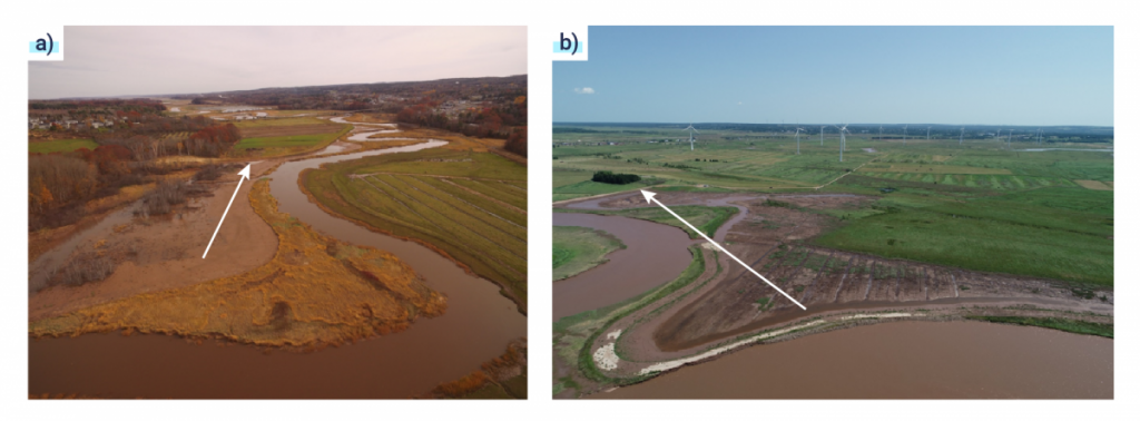
Figure 1.6: Aerial views of early-stage tidal wetland habitat recovery (brown mudflat areas) at a) Belcher Street managed realignment site, near the Cornwallis River in NS, in September 2018 (four months post-breach); and b) Aerial view of developing intertidal habitat at the Converse managed realignment site in August 2019 (eight months post-breach). Arrows indicate location of realigned […]

Aerial views of early-stage tidal wetland habitat recovery (brown mudflat areas) at a) Belcher Street managed realignment site, near the Cornwallis River in NS, in September 2018 (four months post-breach); and b) Aerial view of developing intertidal habitat at the Converse managed realignment site in August 2019 (eight months post-breach). Arrows indicate location of realigned dyke.

Source

Photographs courtesy of CBWES Inc.