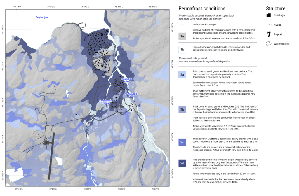
Figure 6.4: Landscape geohazard map for Salluit, Nunavik, summarizing permafrost thaw hazards at the local level. This map was used to inform planning and development in the community and at its airport. Source: Adapted from Allard et al., 2020.
Landscape geohazard map for Salluit, Nunavik, summarizing permafrost thaw hazards at the local level. This map was used to inform planning and development in the community and at its airport. Source: Adapted from Allard et al., 2020.