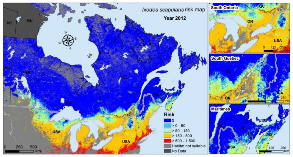
These risk maps measure the environmental suitability for the tick vector of Lyme disease Ixodes scapularis in Eastern and Central Canada using Earth observation data proxies for temperature (annual cumulative degree-days above 0°C) and woodland habitat. The environmental suitability is zero where there is no woodland habitat (lighter grey areas) and where the climate is too cold (dark blue areas). In areas of woodland habitat, and where climate is warm enough, risk of occurrence of tick populations varies from low risk (pale blue areas) through moderate, moderate-high, and high-risk areas (represented by green, orange, and red areas, respectively). The scale of suitability for the tick according to temperature conditions (with values from 0 to 1500) is obtained from a mathematical model of I. scapularis populations. Earth observation data for this map were not available for parts of Nunavut and the Northwest Territories (shown by dark grey areas).
Source
Kotchi et al., 2019.