Understanding and Assessing Impacts
A comprehensive assessment of climate-related risks was undertaken for the projects to identify potential impacts on infrastructure, ecosystems, and buildings. The analysis of climate impacts was conducted by the consultant team, which includes engineering and environmental specialists from AECOM and Jacobs, who utilized data and frameworks from provincial authorities and organizations like the CSA Group to structure their assessment.
- Impacts on infrastructure: The primary risks identified for infrastructure were flooding and sea level rise. An increase in sea level will impact the effluent pumping systems of the WWTP increasing the static head required to discharge treated water, thereby increasing energy consumption. More frequent and extreme rainfall events in the future will further affect pumping requirements. The assessment concluded that without mitigation, these hazards pose a significant threat to the plant’s long-term viability.
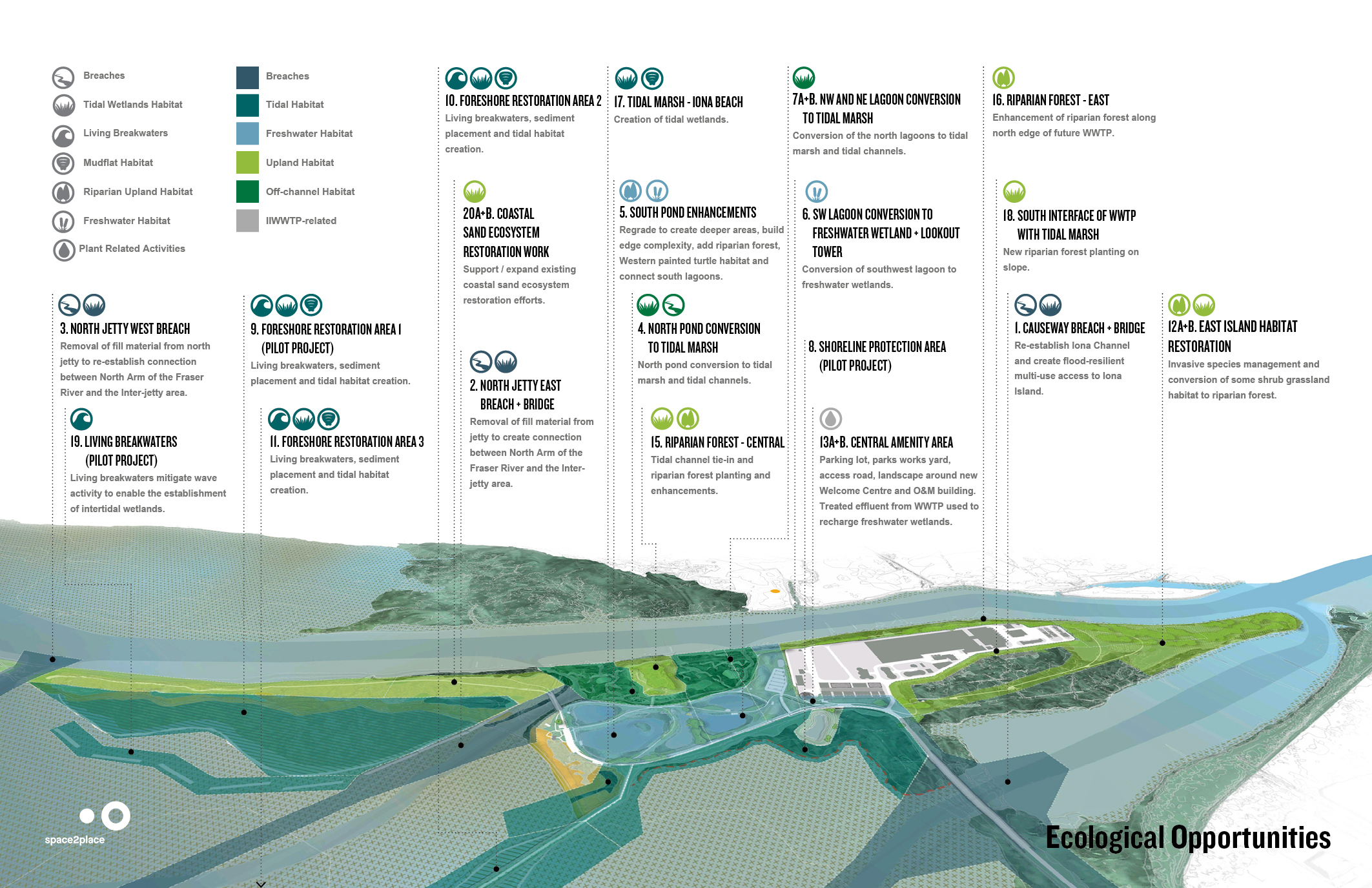
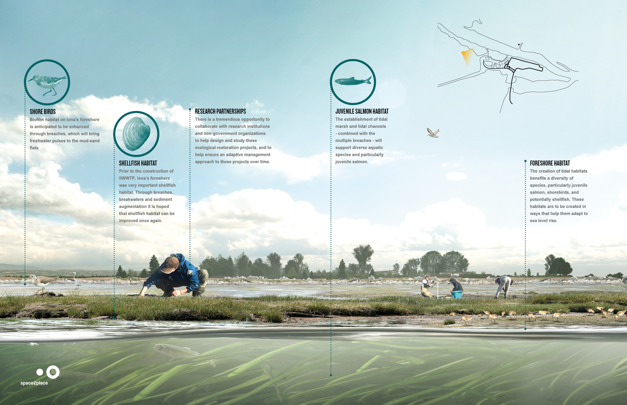
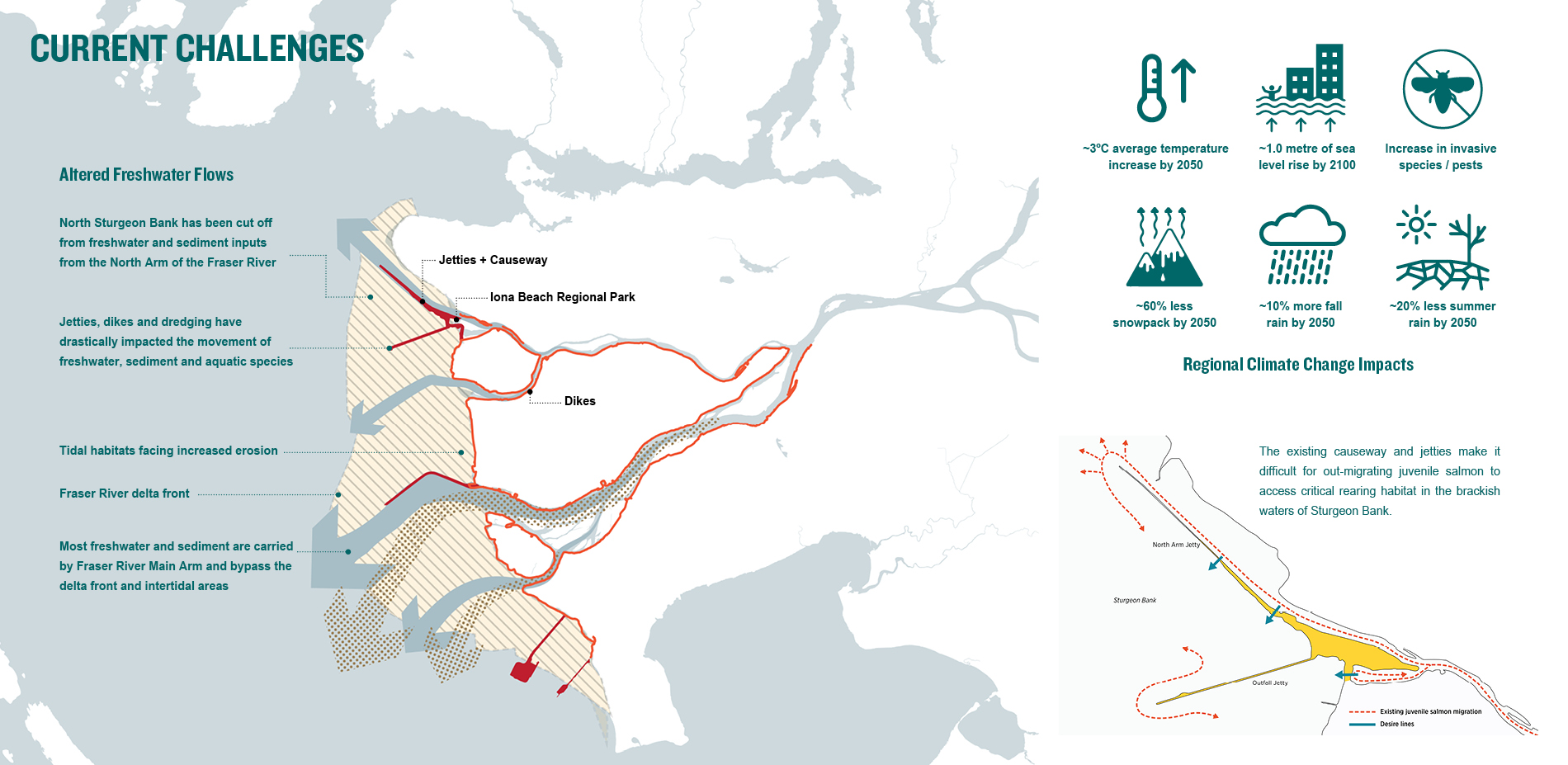
- Impacts on ecosystems: The assessment identified that sea level rise threatens to submerge tidal areas, while warmer temperatures, drier summers, and wetter winters will place stress on terrestrial habitat. The coastal wetlands are highly vulnerable due to low accretion rates and lack of space for upland migration.
- Impacts on buildings: For buildings on the site, the assessment considered stressors such as flood vulnerability, warmer temperatures (increasing cooling demand by up to six times), higher wind speeds, and decreased air quality from wildfire smoke, which complicates ventilation strategies.
Use of climate information in decision-making
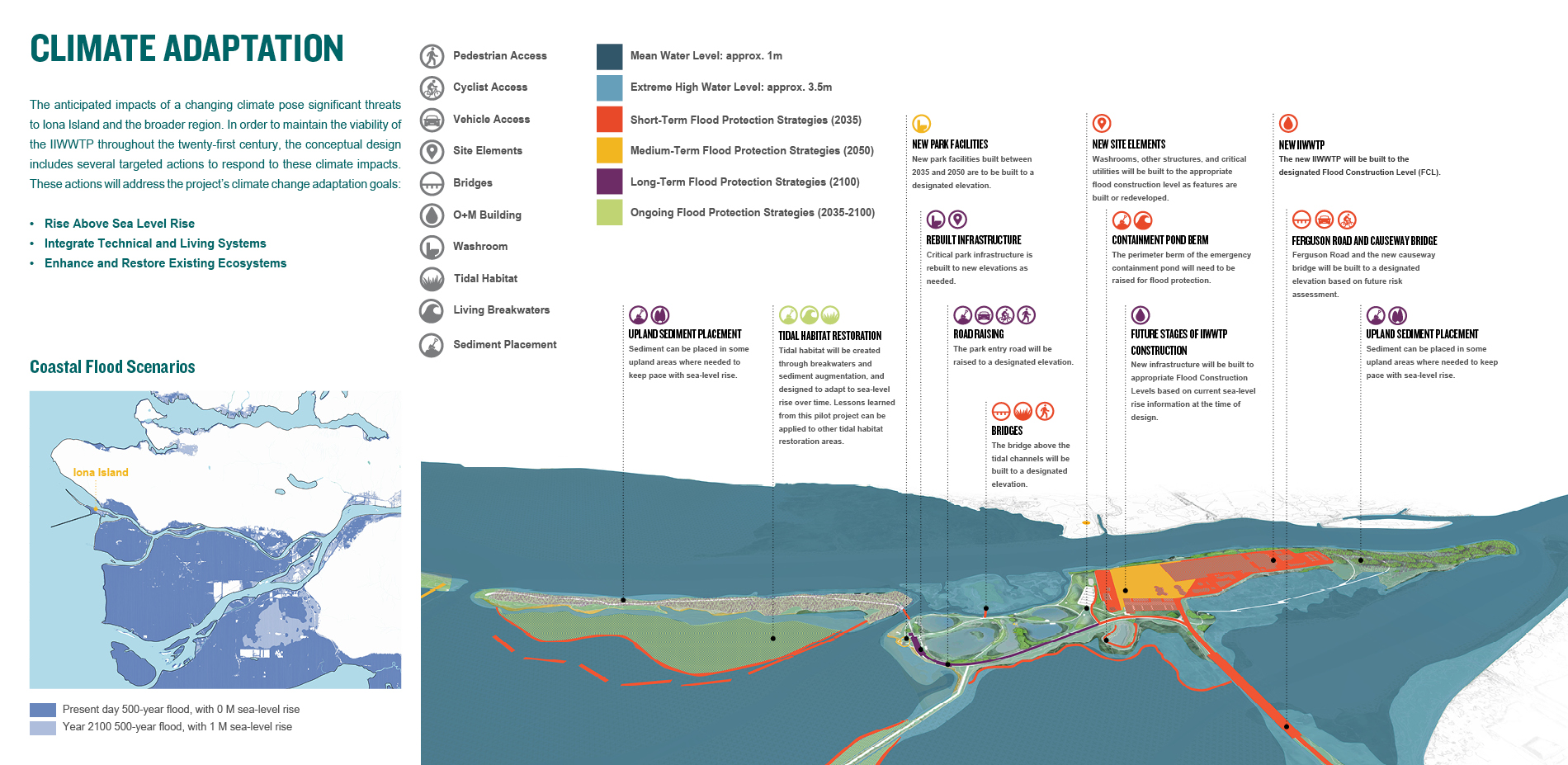
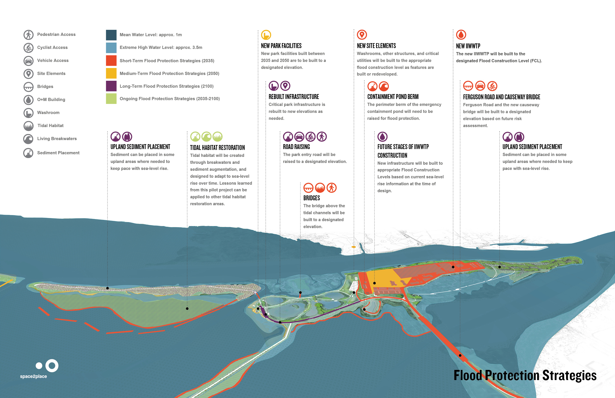
Climate change poses a significant threat to Iona Island, with projections estimating 1.0 metre of sea level rise by 2100. Earlier stages of the project were developed with fewer climate datasets. As new studies and climate data become available, the design continues to be revisited accordingly. As a foundational element in the project’s decision-making process, climate information continues to directly influence the proposed long-term resilience strategies. The design for the projects is informed by regional climate projections for Metro Vancouver to prepare for future conditions, ensuring the plant remains viable throughout the 21st century.
- The primary climate data variables used, include:
- Warmer average temperatures
- Wetter autumns and winters with more extreme precipitation
- Longer, drier summers
- Decreased snowpack
- Sea level rise (SLR)
- The project considers multiple time horizons and thresholds to align with its staged implementation and long service life, which include:
- By 2050: An SLR of +0.5 meters (m). Temperatures are projected to increase by 3°C, with summer precipitation decreasing by 20% and winter precipitation increasing.
- By 2100: An SLR of +1.0 m, considered for establishing the Flood Construction Level (FCL).
- By 2200: An SLR of +2.0 m, considered for long-term planning beyond the primary design horizon.
- Data Sources: The climate information was accessed from several key reports and guidelines:
- Metro Vancouver’s Climate Projections for Metro Vancouver, 2016 report as a primary source for temperature and precipitation projections.
- Provincial guidelines, specifically the Climate Change Adaptation Guidelines for Sea Dikes and Coastal Flood Hazard Land Use, for the basis of SLR allowances.
- Various U.S. National Oceanic and Atmospheric Administration (NOAA) reports for data on local SLR trends.
- The CSA S900.1:18 Climate change adaptation for wastewater treatment plants, standard for a risk assessment framework.
Climate data continues to directly shape the project’s design. For instance, the FCL for new buildings and structures was set at 7.0 m geodetic, a decision based on projections for SLR, storm surge, land settlement, wave effect, and a freeboard safety factor. Critical infrastructure is placed at or above this level, with watertight protection for lower-level non-critical spaces to account for factors such as land settlement, high tide, storm surge, and wave effects. The design also proposes ecosystem-based flood protection strategies, such as living breakwaters and sediment augmentation, to restore the foreshore and help natural habitats adapt to rising sea levels.
Key environmental and management challenges facing Iona Island
Climate change adaptation strategies